A series on West Kootenay/Boundary place names
Previously in this series we looked at Nelson’s chief residential neighbourhoods of Uphill (formerly the Hoover Addition), Fairview (formerly Salisbury, Nelson City, Bogustown, and Lake View), and Rosemont, as well as South Nelson and Mountain Station.
But there are several others, although a few have vanished, such as Parklands and Kensington. The former was mentioned in the Nelson Daily News of Feb. 18, 1911: “F.B. Lys reported the sale of a one acre block in the Parklands subdivision east of the city, where much settlement and building has been going on during the past 12 months.”
No further mentions of Parklands have yet been discovered. Presumably it was near Lakeside Park and subsumed by Fairview, but it’s unclear.
Kensington was mentioned in a large ad by the Ferguson Land Co. in the Daily News of April 24, 1913 and described as “just west of the CPR depot and workshops, between Rosemont and the Kootenay River. It is traversed by the beautiful Granite Road … and is a continuation of Silica Street.”
The ad also carried some terrific purple prose: “At night when the Electric City shines like a blaze of diamonds the view across the city and up the lake rivals a scene from the Arabian Nights. This scene has no equal in the Kootenays.”
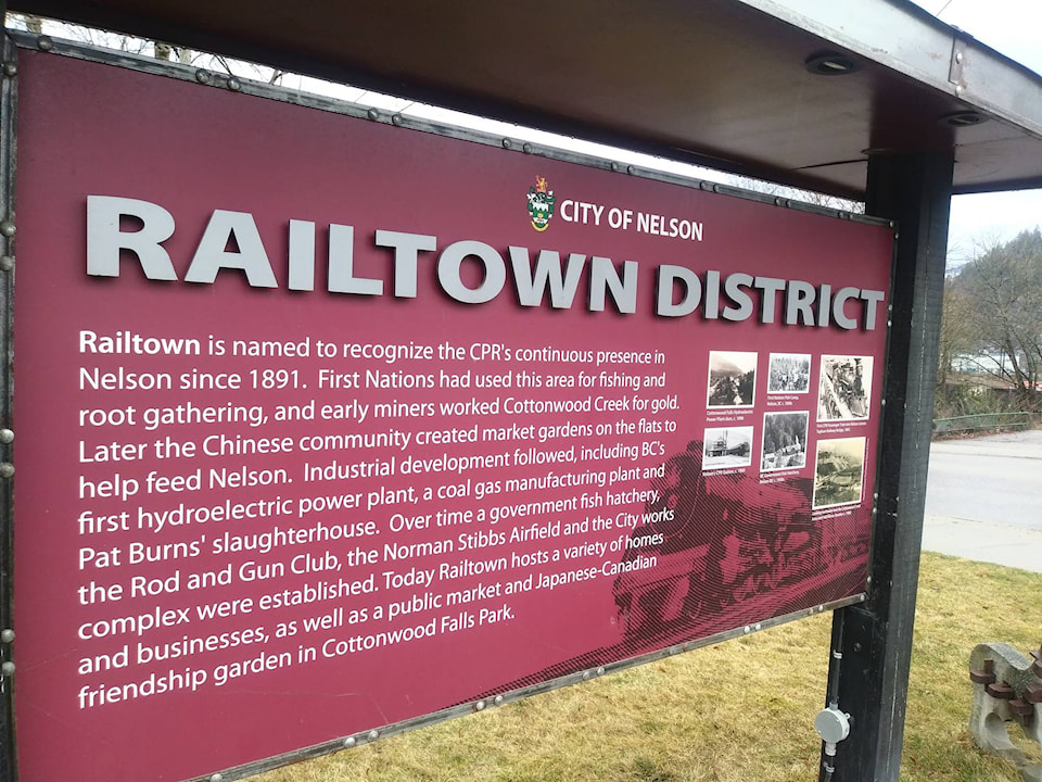
An item on May 9 reported the sale of five lots and one acreage in the subdivision. But Kensington didn’t amount to anything. Today it’s part of what’s known as Railtown.
Railtown itself is Nelson’s newest neighbourhood name, coined in 2011 by the City of Nelson to cover the area that includes Government Road, Railway Street, and portions of Baker and Silica streets. However, it’s unclear who deserves credit for coming up with the name.
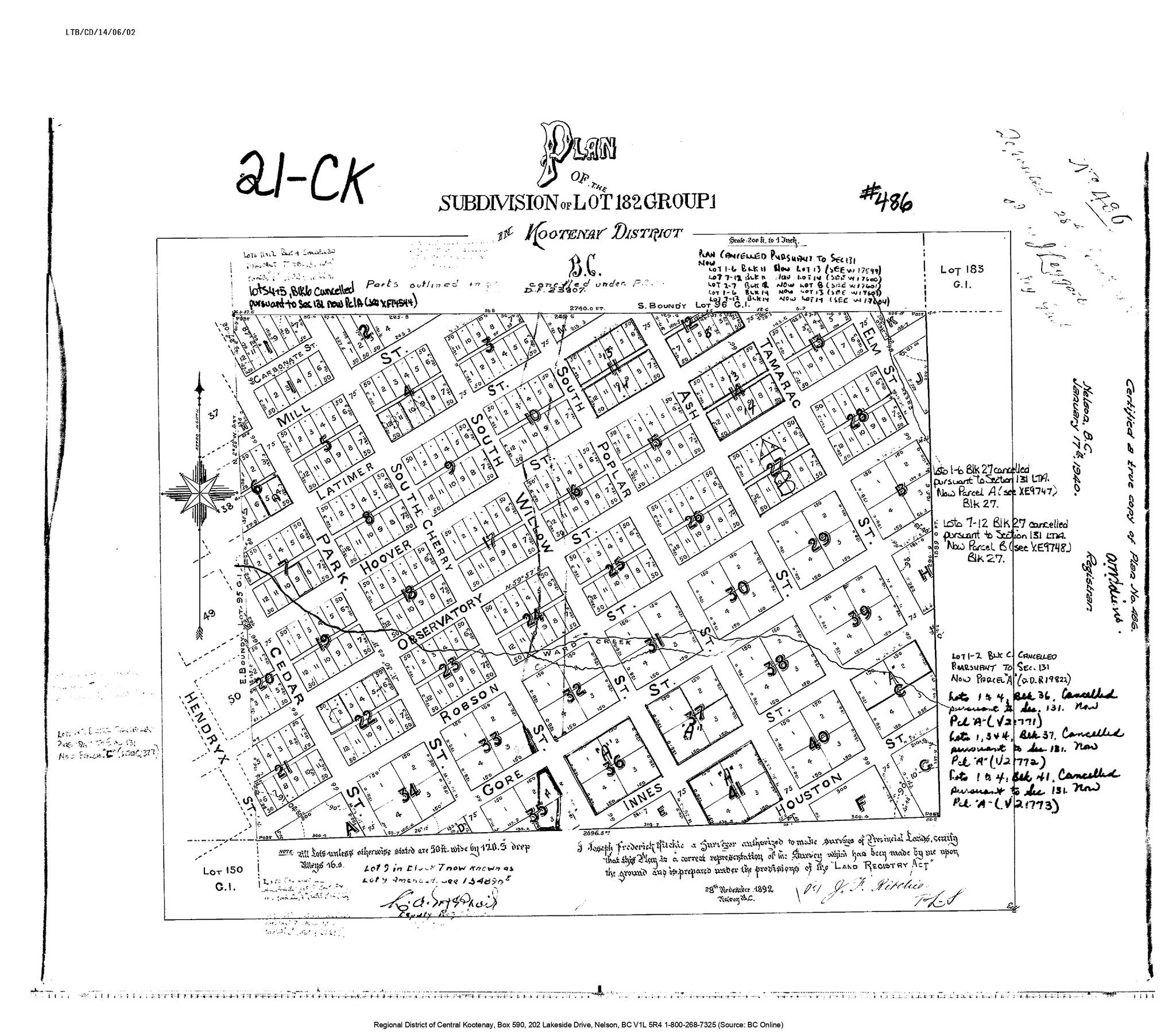
Two other names that have gone by the wayside are the Davies Addition and Hume Addition. The former was named for Joshua Davies (1846-1903), managing director of the Nelson City Land and Improvement Co., and surveyed by J. Fredrick Ritchie in 1892. However, it didn’t become a going concern for another five years and only a portion of the addition as surveyed actually exists today in South Nelson because the Great Northern Railway’s line, completed in 1893, cut through it.
The original plan extended Carbonate, Mill, Latimer, Hoover, Observatory, Robson, Gore, Innes, and Houston streets to the east, and Cedar, Park, and Cherry streets to the south. It also added north-south streets Willow, Poplar, Ash, Tamarac, and Elm.
Today only a small portion of Willow Street survives, while portions of Poplar and Ash can be found in the Mountain Station neighbourhood. Tamarac and Elm do not exist. Hoover through Houston streets never got as far east as intended.
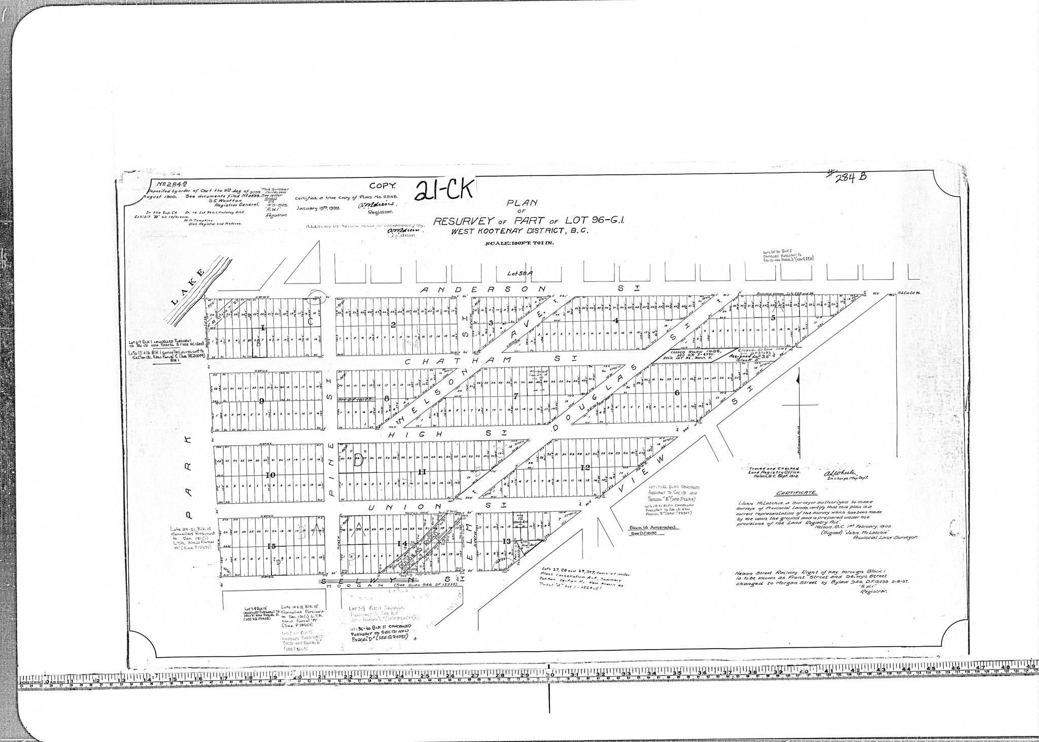
The Hume Addition, named for merchant J. Fred Hume (1861-1935) and family, was laid out in 1891. It was resurveyed in 1900 by John McLatchie after discrepancies were discovered with the original plan. It includes Anderson, Chatham, High, Union, Morgan (formerly Selwyn), Pine, Elm, and View streets, plus Nelson Avenue and Douglas Road (formerly Douglas Street).
(In addition to this addition, Hume had a hotel, school, and creek named after him, but there is curiously no Hume Street in Nelson.)
What is this neighbourhood called today? It’s a bit unsettled. At least part of it would be regarded as an extension of Fairview, but the rest is sometimes referred to informally as the Gyro neighbourhood, after Gyro Park, or Gyro-Hospital.
The Telus phone book says the 825 phone exchange is “North Nelson,” a place name that doesn’t otherwise exist. However, a post office application was filed in 1900 under the name North Nelson, with the office to be placed on Chatham Street in the Hume Addition. It never opened.
West Nelson isn’t really a place either, but a boundary expansion in 2003 described it as the lands west of the CPR yards – probably what was once Kensington.
City limits expanded across the West Arm of Kootenay Lake in 1991 to take in a small portion of the North Shore. Another expansion in 1993 added more properties along Highway 3A plus Shutty Road and a portion of Johnstone Road.
Johnstone Road seems to be the only name for the neighbourhood on the north side of the Nelson Bridge, named for fruit rancher James Johnstone (1863-1922), who had orchards there (the ranch was called Summerholme).
The neighbourhood also includes Parkview, Whitmore, Goddard, Valhalla, and Gagne roads.
We’ll continue looking at Nelson neighbourhoods next week.