Two hundred seventy-fifth in a series on West Kootenay/Boundary place names
For the next several weeks, we’ll look at neighbourhood names — official and unofficial — of West Kootenay/Boundary.
Nelson, it must be said, has some of the most boring such names. The chief residential districts are Uphill, Fairview, and Rosemont. Can it get any more generic?
As we’ve previously seen in this series, Fairview was originally Salisbury, or Salisbury Landing, names that were also applied to Nelson as a whole — at least by those who didn’t live there.
Victoria investors had the area surveyed as a townsite known as Nelson City. The first ad appeared in the Victoria Daily Colonist on Aug. 7, 1889 and an auction of lots was held later that month.
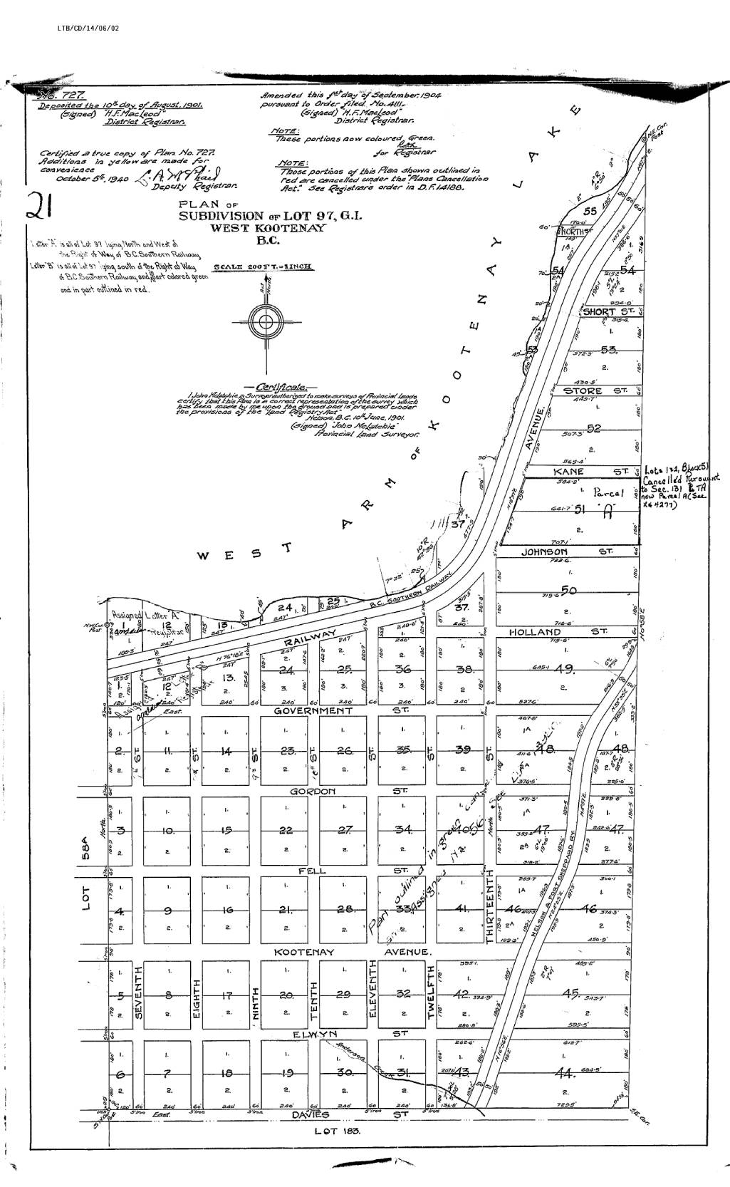
The original east-west streets were named alphabetically, mostly after the investors themselves: Anderson, Behnsen, Cottonwood, Davies, Elwyn, Fell, and Gordon. Kootenay Avenue, however, fell between Fell and Elwyn; it was later renamed Kokanee. The original north-south streets were Oak, Pine, Maple, and First through Sixth, plus Nelson Avenue.
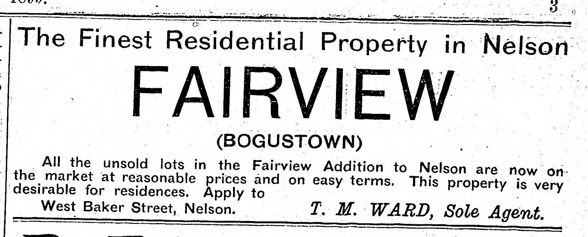
Many people apparently bought lots sight unseen, believing they were getting valuable property in what’s now downtown. That, plus the Nelson City Land and Improvement Company’s failure to pay its bills on time, resulted in the delightfully disparaging nickname of Bogustown, first mentioned in the Nelson Miner of June 21, 1890. It was Nelson’s best neighbourhood name, but never official.
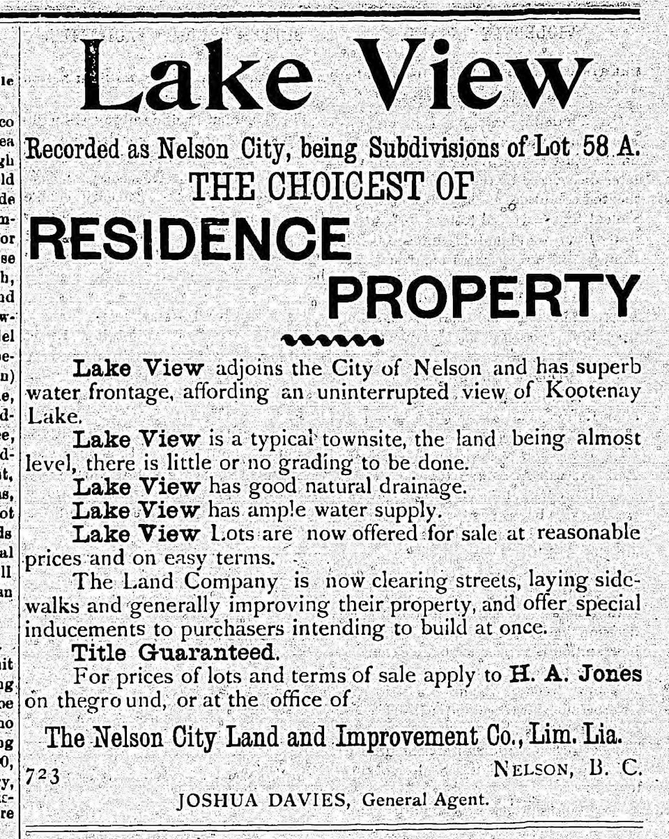
In 1897, the real estate company tried to rechristen the area Lake View. It didn’t stick. Next it became Fairview, first mentioned in a real estate ad in the Nelson Tribune of Sept. 12, 1899 — although it was a long time before locals stopped calling it Bogustown. The latter was perpetuated until recently by the Bogustown pub and restaurant, but alas, the name seems to have finally fallen by the wayside.
Fairview is divided into upper and lower sections between Sixth and Seventh streets. Everything up to the middle of Sixth was added to city limits in 1921 but it took until 1961 for Seventh through Thirteenth to become part of the city, along with Government Street, Holland Street, and parts of Beatty Avenue and Bealby Point Road. (Twelfth and Thirteenth are dirt roads without signs.)
Provision was also made by 1912 for four other streets at Fairview’s north end that were never built: Johnson, Kane, Store, Short, and North. (Holland, Johnson, and Kane would have almost continued the alphabetical sequence after Gordon Street — but no street started with I.)
More recent additions are Foster Place and Hampton Gray Place in Fairview Heights, a subdivision developed in the 2000s in a former gravel pit at the top of Davies Street. Fairview also includes what was once known as the Hume Addition, which we’ll study separately in this series.
Rosemont, meanwhile, is everything west of Cottonwood Creek, bounded by Highway 3A on the north, Silver King Road on the south, and Golf Links Road on the west.
Rosemont was originally called Smelter Hill, since it was home of the Hall Mines smelter. The Nelson Daily News of Sept. 27, 1910 noted: “The residents of Smelter Hill applied for water service in the following terms: ‘We, the undersigned, wish to make application for water on Smelter Hill, using the same for taps that are already in, at the usual rate per month …’”
A.H. Green completed the Rosemont Addition survey on Aug. 21, 1912, but the plan doesn’t appear to have been deposited in the land registry until more than a year later.
Some streets adopted the same names as corresponding streets across the Cottonwood Creek canyon; hence West Richards, West Houston, West Innes, and West Gore. Additionally there were Wasson and Munro streets and Hamilton Avenue.
The original north-south streets were Crease, Jeffs, McQuarrie, and Robertson Avenues — plus Tramway Street, which would have been the main thoroughfare and cut diagonally through several blocks. No streetcar ever served Rosemont, however, and Tramway Street was never developed.
Later, McHardy and Water streets and Lakeview Crescent were developed where the smelter once stood. Kary Crescent, Gilker Street, Choquette Avenue, and West Beasley were other subsequent additions. A short-lived street, Crossley Avenue, was a casualty of the highway interchange project of the early 1970s.
Most of Rosemont was outside city limits until boundary expansion in 1961. A map on the City of Nelson’s website, however, indicates Vancouver Street, Slocan Street, portions of West Houston, West Innes, and West Gore were included within the city when it incorporated in 1897, along with a portion of Hall Mines Road.
Rosemont takes in Granite Pointe Golf Course, which joined the city in 1992, as well as the Silver King campus of Selkirk College.
Next: An Uphill battle