Two-hundred ninety-fifth in a series on West Kootenay/Boundary place names
The original Greenwood townsite, surveyed by John A. Coryell in 1896, consisted of streets named after either precious minerals or area mining camps.
The north-south ones were Gold, Silver, Copper, Government, Long Lake, Skylark, and Summit and east-west were Deadwood, Centre, Greenwood, and Short.
These names all survive except Short Street is now Veterans Lane. The original Summit Street does not exist, but the name is applied on some maps to what used to be Skylark Street south of Greenwood Street.
Within a few years, at least eight townsite additions expanded the available real estate.
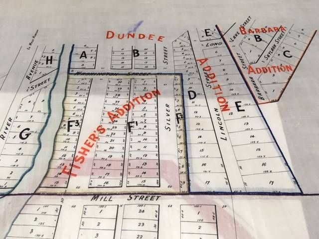
• The Dundee Addition was named after the mining claim southwest of the original townsite on which it was platted in 1897. The owners were James Sutherland and Robert Wood.
The addition expanded Gold and Silver streets, added another north-south street in Lincoln (now South Silver Avenue), new east-west streets Wellington and Washington, and a northeast-southwest street named Dundee.
• The Dundee Addition wrapped around Fisher’s Addition presumably named for Adolph Fisher of the Boundary Creek Milling and Lumber Co. First mentioned in 1899, it further extended Gold and Silver streets south. Washington Street divided Fisher’s Addition from the Dundee Addition on the north while Mill Street divided Fisher’s from Garland’s Addition on the south.
• Garland’s Addition, probably named for realtor Thomas A. Garland, first appears in 1898. Its north-south roads were Gold, River, Mamont, and Ditmar, while east-west roads were Mill, Mowat, and Garland. Only Gold and Mill streets survive; the rest are long gone.
• Sutherland’s Addition was west of Garland’s Addition, across the Columbia and Western Railway right-of-way. It dates to 1898 and was named for mining operator James Sutherland, who had it laid out on another part of his Dundee claim.
It appears to have been developed in two stages. The first section was platted between the Columbia and Western on the east and a spur to the Mother Lode mine on the west. North-south avenues were Railway and Sutherland, while southwest-northeast Washington Street was extended across the railway tracks from Garland’s Addition.
Later, Railway and Sutherland avenues were extended further south, and a third north-south street called Glenwood Avenue was added along with another east-west street, Smelter, on the south. The latter two no longer exist.
• The nearly-triangular Barbara Addition, laid out by surveyor Sidney M. Johnson in 1899, was named after a mineral claim. It’s east of the Dundee Addition. It extended southwest-northeast streets Long Lake and Skylark (which no longer exists) and added north-south street Barbara.
• First Addition North and Second Addition North vastly expanded the town, from Deadwood Street in the south to Dalziel Street in the north, and from Copper Street in the west to Strathmore Avenue in the east.
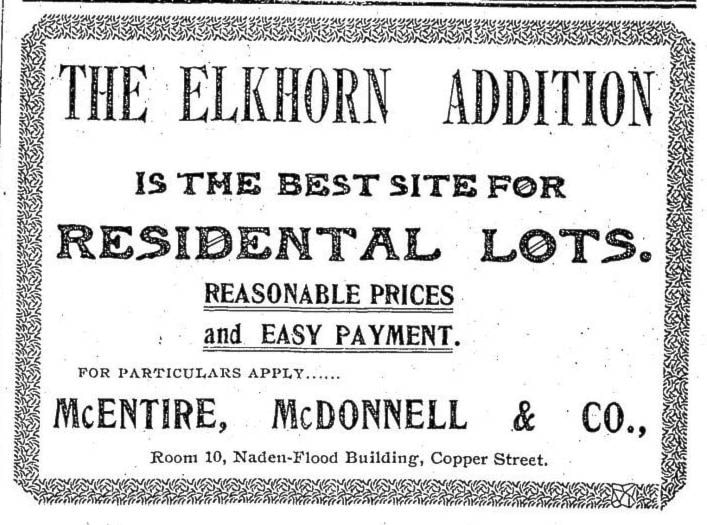
• The Elkhorn Addition, first mentioned in 1899, was furthest north. Charles L. Thomet had it platted on the Elkhorn mining claim. While its exact boundaries are unclear, it presumably added Thomet Avenue (later renamed Elkhorn Street), Gowrie, and Davidson streets to the map as well as extending Kimberley and Strathmore Ave.
None of these additions survive as distinct neighbourhoods, although Sutherland, Dundee, Barbara, and Elkhorn streets all perpetuate their names.
Greenwood does have a suburb immediately south of city limits. Anaconda was previously discussed in this series. The townsite, surveyed in 1896, had a couple of additions itself, the Western and Capital Prize, although exact boundaries are unclear.
GRAND FORKS STREET NAMES, REVISITED
A 1912 fire insurance map of Grand Forks reveals old names of streets in two townsite additions we’ve previously studied. In the North Addition, only Riverside Drive retains its original name. What is now 77th Avenue was once Pine, 78th was Walnut, and 79th was Gold.
The portion of Riverside Drive that turns northeast was formerly Wellington Avenue. It looks like 80th Avenue was Boneta and 81st was Hamilton. Or possibly Boneta no longer exists and 80th was Hamilton; it’s hard to say for sure.
Meanwhile, 69th Avenue in the North Ruckle neighbourhood was once Portland Avenue, 68th was Ruckles Avenue, and a street that would be 67th today if it still existed was originally called Denver Avenue.
— With thanks to Doreen MacLean and Wendy Higashi