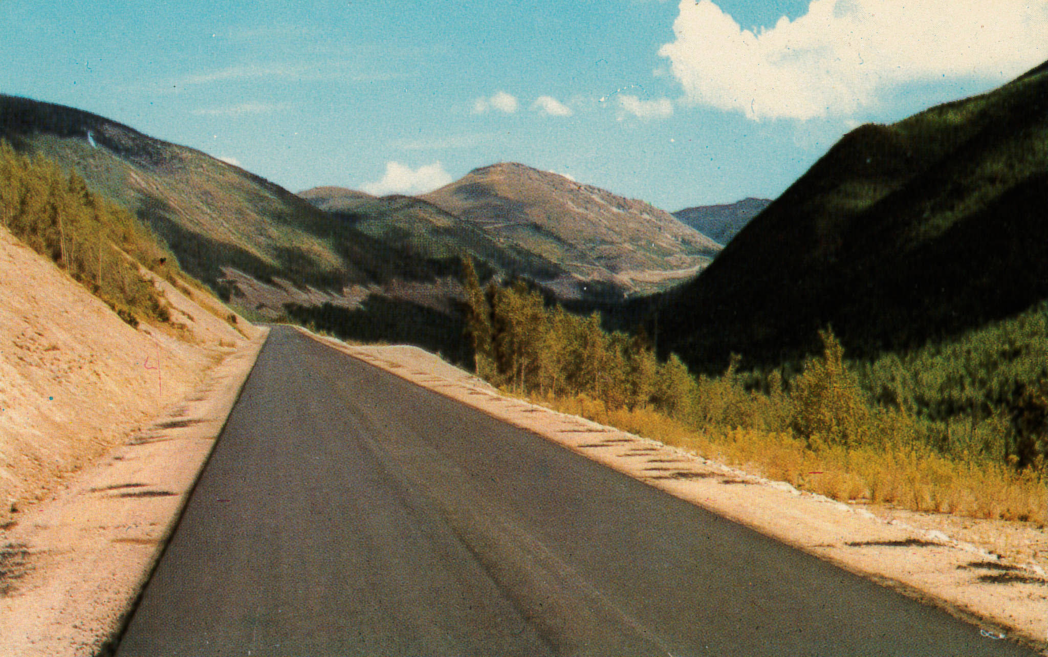
Before the stretch of Highway 3 between Salmo and Creston opened, there was great debate over what to call it, given its high elevation.
Although commonly referred to during construction as the Salmo-Creston cutoff or link, the Trail Daily Times of Jan. 27, 1964 reported that the local historical society supported the name Dewdney Trail.
But the Associated Chamber of Commerce of Southeastern BC wanted the name Kootenay Skyway. The BC government cabinet preferred Kootenay Pass.
As the Bluebell Miner of August 1964 recorded, government offices themselves couldn’t agree:
“The highways department called the term [Kootenay Skyway] promotional abandon saying a skyway is an elevated highway on legs. The recreation department, trying to woo tourists, believes the glamour approach is justified. Just to confuse things, Premier Bennett has said that it will be called the Southern-Trans Canada Highway, even though the federal government did not participate in construction.”
Nelson-Creston MLA Wes Black convened a media conference to organize publicity of the highway’s opening, slated for July 1964. According to the Nelson Daily News of April 10:
“Mr. Black explained that the BC cabinet in executive council had unanimously agreed to naming the new highway Kootenay Pass. Because ‘time is not on our side,’ he asked the newsmen to ‘develop’ this name.
“The cabinet felt the name Skyway ‘doesn’t mean anything to us’ and the indication that it was in mountain terrain where continuous snow removal was required was not enticing.”
The story went on: “The newsmen agreed to support Mr. Black in his plea that the name Kootenay Pass be used for the new highway, but expressed the hope the cabinet could be won over to the name ‘Kootenay Skyway.’ … ‘Kootenay’ was the key word in naming the highway, the group agreed, and gave the minister backing by a show of hands. They insisted, however, that the effort to retain the skyway designation be continued … They also supported the minister’s suggestion that the term Southern Trans-Canada Highway be used rather than the present official name Southern Transprovincial.”
And so for years both names were used — as well as Salmo-Creston highway, Salmo-Creston skyway, and Salmo-Creston cutoff. References to Kootenay Skyway can still be found, but Kootenay Pass — and plain old Salmo-Creston — won out.
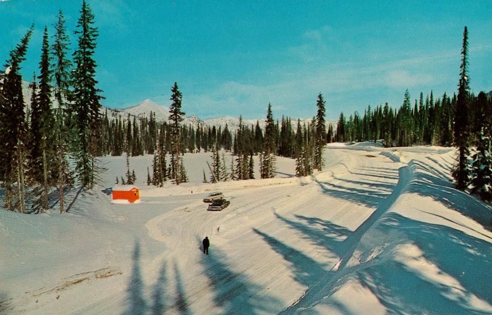
The Kootenay Pass remains one of the highest-elevation mountain passes in Canada that’s open year-round, although it is often closed for avalanche control in the winter.
SLOCAN, REVISITED
Earlier in this series we saw that Slocan is the anglicized version of the Sinixt word slhu7kíń, which means “to pierce, strike on the head,” in reference to the practice of spearing salmon.
Explorer John Palliser first recorded the Shlogan River on an 1859 map. Secondary sources erroneously attributed a wide range of alternate spelling to him including shlocan, sloghan, schlocan, scholocan, slok-ken and shlokum.
In an 1865 letter, trail builder Edgar Dewdney called it slokén, while on an 1866 map, surveyor Walter Moberly wrote slocken. Previously the earliest known use of the present spelling was in Gilbert Malcolm Sproat’s Jan. 7, 1884 Report on the Kootenay Country.
But two earlier references have recently been discovered – the first more than nine years prior to Sproat’s report. The Victoria Daily Colonist of Dec. 25, 1874 wrote: “Captain Pingston returned to Colville with the steamer 49 with a prospecting party, who have been prospecting above the mouth of the Kootenay River. They report diggings that will pay from $5 to $6 per day to the hand on the Slocan River and its tributaries.”
(Pingston has a creek and a locality on Upper Arrow Lake named after him.)
The second reference is from a book called the Guide to the Province of British Columbia for 1877-78, published in 1877: “The prospecting parties out in 1874, aided by the Government appropriation, have done well … on the Slocan River, and above the mouth of the Kootenay River.”
This minor gold rush was followed by another in the mid-1880s, to which two references survive.
Victoria Daily Colonist, July 21, 1885: “A miner arrived [at Farwell] from Kootenay Lake the other day and brought some fine specimens of galena ore … The returned miner also reports having found gold on Slocan stream. The Slocan is 30 miles long and comes from a lake not shown on the map, east of and parallel to low Arrow Lake, and flows into the Kootenay river nine or ten miles from its junction with the Columbia.”
And from the Canadian Mining Review, August-September 1885: “Thirty to 40 miners are reported at work at Lake Kootenay, in galena ledges. Gold has been discovered on Slocan stream, a tributary to the Kootany [sic] river, about ten miles from its junction with the Columbia. Development of these claims will, however, be retarded owing to the difficulty of access, which renders it impossible for prospectors to take in tools and other means wherewith to test their discoveries.”
Silver, not gold, would turn the Slocan into a major mining region beginning in the fall of 1891.