Three hundred and second in a series on West Kootenay/Boundary place names
Last week we started looking at Nelson’s lesser-known neighbourhoods, including some whose names have fallen from use.
Another in the latter category is Cottonwood City, what we’d now call the Ymir Road area, including Perrier, Cottonwood, and Kline roads.
In 1933, about 100 shacks sprung up an old rifle range south of Nelson, established by men who were either unemployed or on relief work. It was a squatter’s camp, but no attempt was made to evict them.
As the Nelson Daily News described it on May 9, “It is estimated the population of Cottonwood City has now passed the 300 mark, that number of men alone being resident there, in Cottonwood valley, and on the bench rising from it on the west …”
Married couples and families soon started moving in. Fred Rapley, the unofficial mayor, claimed “trouble is practically unknown, and that one would go far to find a community as orderly as Cottonwood City.”
The Daily News added: “Saving of rent at a time when no money is coming in is the reason given by various of the newest residents of Cottonwood for their joining the community.”
The earliest known use of the name was in The Vancouver Sun of April 15, 1933: “It is reported that there are many ardent anglers in ‘the jungle’ and in Cottonwood City.”
In 1947, the government finally ordered a proper survey of the area so people could get title to their land. Boyd Affleck was hired to divide the area into 64 parcels and residents were given the right to buy their property or leave and receive compensation.
Ray Johnson, then 15, was Affleck’s assistant and spent the summer determining how much land each person should have or what they should be paid for their improvements.
“Here are people cultivating the land who might think they’ve got the right to get more,” Johnson recalled in a 2012 interview. “You’d come up to somebody and say ‘We’re going to survey it out, you’re allowed to buy it, but if you don’t …’”
Amazingly, there were few arguments. It helped that Johnson’s own family arrived there in 1934, so he knew everyone in the neighbourhood. His own parents decided to buy their land.
The name Cottonwood City fell out of use by the mid-1950s. The latest known newspaper reference is from the Nelson Daily News of Feb. 27, 1951. The 1951 and 1953 civic directories carried a listing that said “Cottonwood City – See Ymir Road.”
• We’ve previously covered Bealby Point (officially Bealbys Point) in this series, which is outside Nelson city limits but you have to drive through the city to reach it.
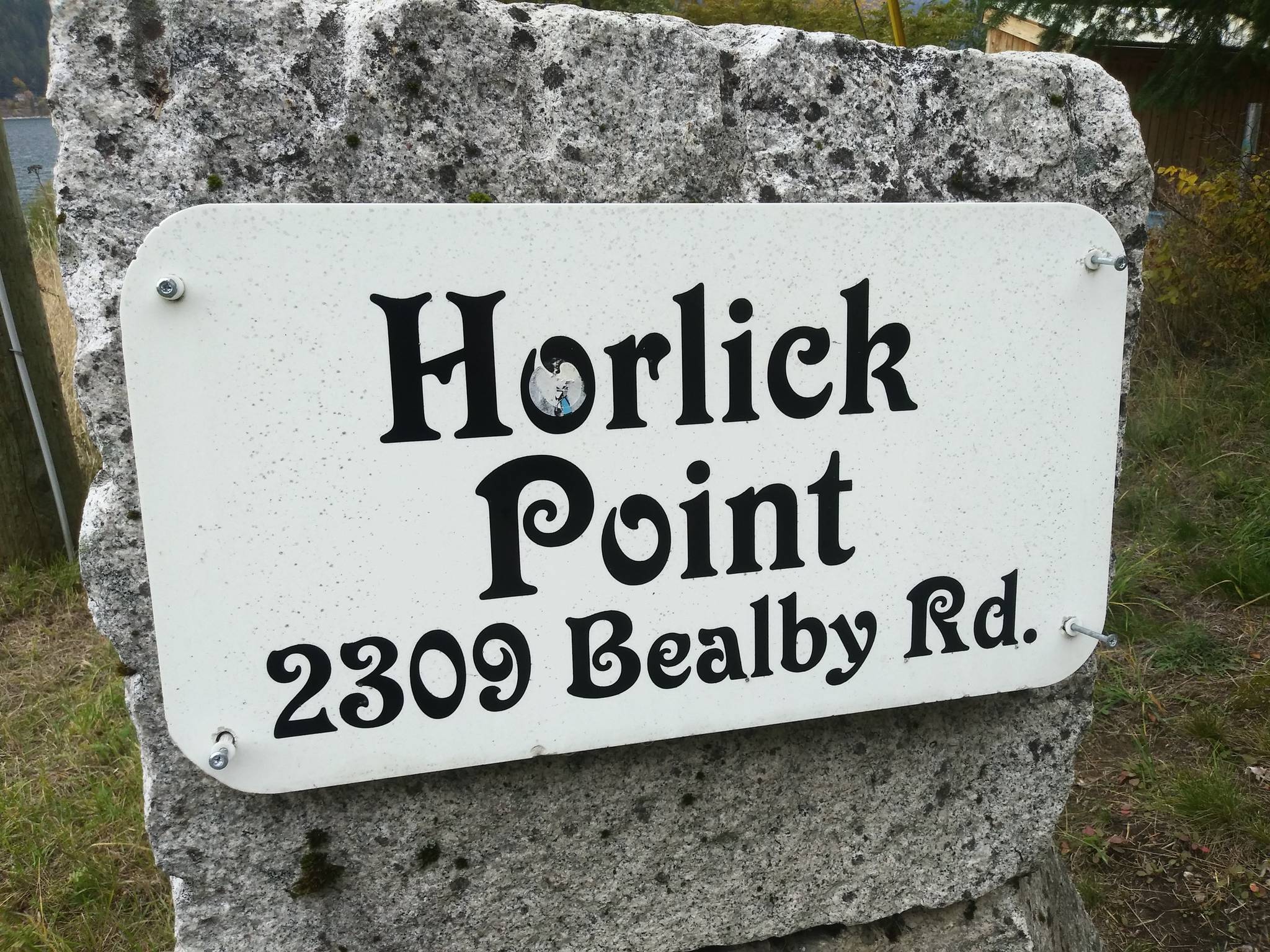
Keep going less than a kilometer northeast along Bealby Point Road and you’ll reach Horlicks Point (or Horlick Point), named for Romanian-born miner John Horlick (1888-1969) and wife Carolina (1892-1962), who lived there. The place name appeared on Carolina’s death registration, although it’s not officially recognized.
Their son Leslie died last year at 92. According to his obituary, “The Horlick family were pioneers of the Nelson region, having settled there in the 1890s.” However, no Horlicks appear on the 1901 census — it appears John actually arrived in Canada the following year. On the 1911 census, he and brother William show up working in a mine at Sandon.
On the 1921 census, John and Carolina, along with daughter Freda and John’s cousin John Kuzyshyn, are shown living at “Government Road/Three Mile.” Horlicks Point was previously Three Mile Point.
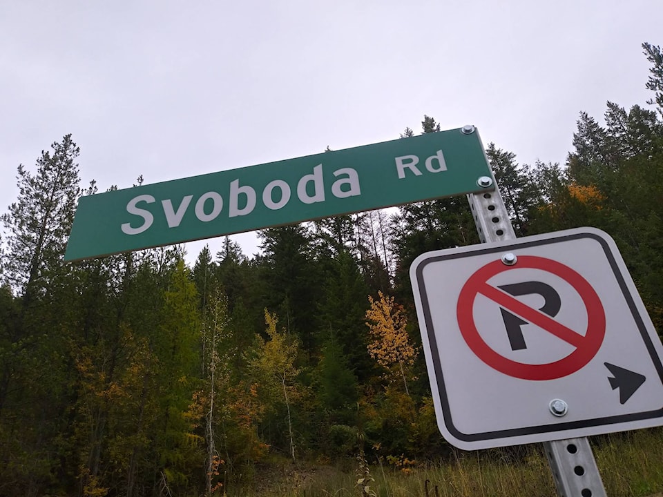
• Svoboda Road, a rural neighbourhood outside city limits above the former Great Northern rail grade, is named after the Svoboda family, who had a ranch in the area. John (1859-?) and Annie (1865-?) Svoboda were in Nelson by 1901 and ran a Hall Street grocery with their children.
• A previous installment in this series noted that figuring out when Uphill was named Uphill is proving difficult. The earliest reference yet discovered is from 1944.
But two items in the Spokane Spokesman Review may provide some insight. The Jan. 28, 1934 edition noted people still attended a Burns’ night banquet, although Nelson’s streets were icy, “even bordering on dangerous in parts of the uphill sections.”
The Review of Oct. 26, 1938 also noted: “The first snow of the fall season touched the outskirts of Nelson yesterday when a light fall was noted in the uphill section.”
Uphill wasn’t capitalized in these instances, suggesting the name was in use informally but not yet official.
We’ll conclude our look at Nelson neighbourhoods next week.