Three hundredth in a series on West Kootenay/Boundary place names
The land on which most of New Denver was built was staked by Angus McGillivray in October 1891. But before he could do anything with it, a government reserve was placed on the mouth of Carpenter Creek to keep land speculation in check.
The fledgling city of Eldorado grew up haphazardly on the site anyway, until the government sent Charles E. Perry to head up a proper survey the following year.
The townsite that Perry’s team plotted straddled Carpenter Creek and consisted of north-south avenues Eldorado and Bellevue, plus east-west First through Seventh, with Slocan Avenue falling between Fifth and Sixth. Some existing cabins and shacks had to be removed, as they fell in the middle of the new streets.
With an auction of lots in July 1892 came a name change, from Eldorado to New Denver.
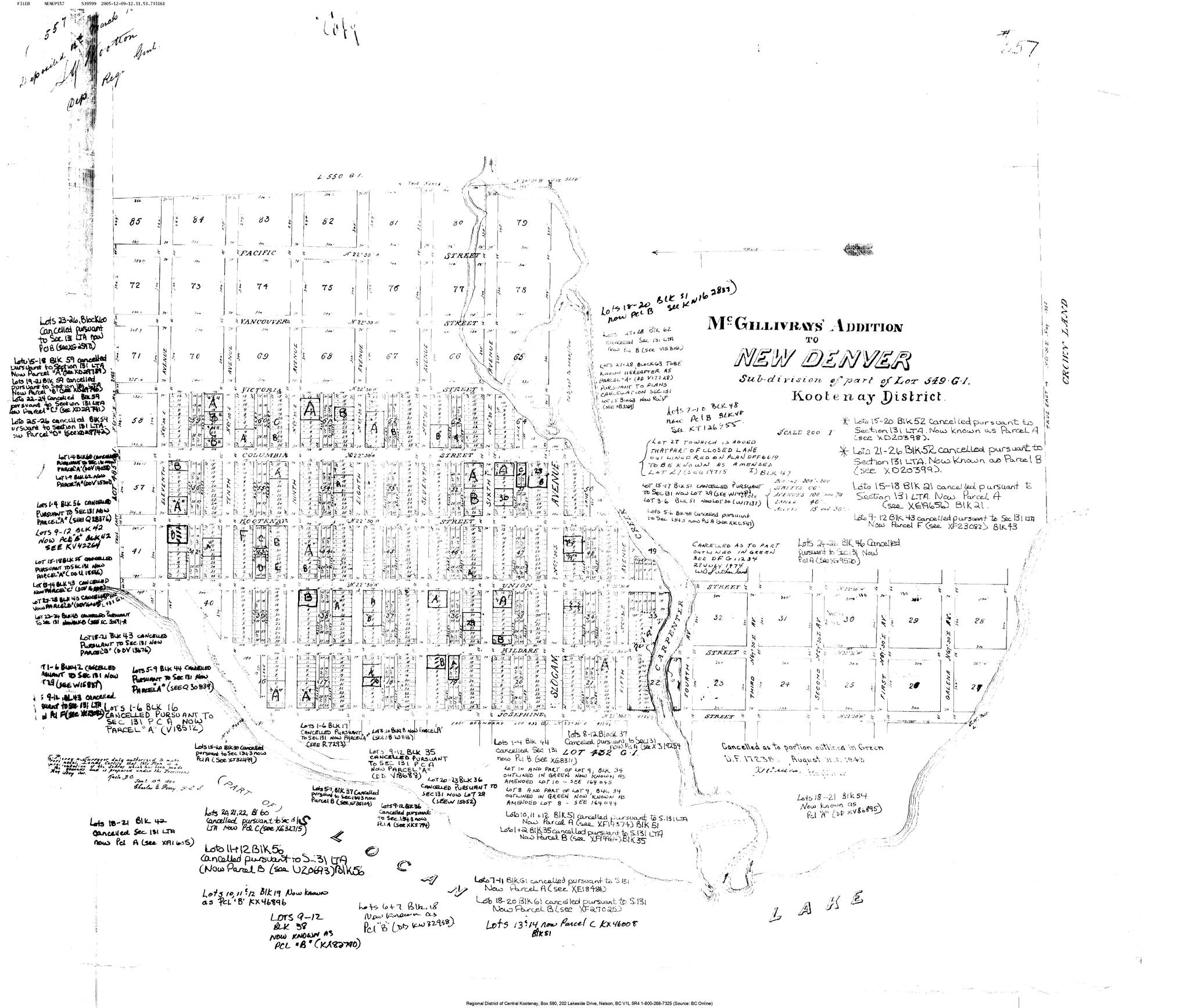
• The townsite only represented part of the land McGillivray staked. After the government quietly lifted its reserve in September 1892, McGillivray hired Perry to survey the rest of his property.
However, ownership of McGillivray’s Addition was disputed and resulted in extensive litigation before a settlement was reached.
When the map was finally deposited with the land registry in early 1894, it added north-south avenues Josephine, Kildare, Union, Kootenay, Columbia, Victoria, Vancouver, and Pacific plus eighth through 11th streets on the west and Galena Avenue on the east. Vancouver and Pacific streets do not exist today. Victoria is now part of Highway 31A.
McGillivray’s name has long since fallen from use.
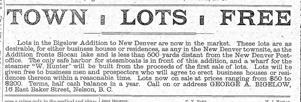
• George Bigelow and Michael Molloy had the Bigelow Addition surveyed by late 1892, northeast of the original townsite. They staked this land adjoining McGillivray’s in 1891, but it was initially caught up in the government reserve. No map of this addition is known to survive, but we know one of its streets was named Wardner.
Lots were offered free “to business men and prospectors who will agree to erect business houses or residences thereon within a reasonable time.”
Despite claims to the contrary, none of the lots had sold by April 1893 when Minnesota capitalists bought the entire property. They don’t seem to have done much with it either by the time the Nakusp and Slocan Railway planned to build its line through the addition in 1894. This led to more litigation, but its outcome is not known.
The name survives in Bigelow Bay, first mentioned in The Ledge of March 14, 1895, although it’s not officially recognized.
• The portion of the townsite south of Carpenter Creek was known informally as Union Bay in the early 1900s, but during the Japanese-Canadian internment, it was called The Orchard after the fruit trees that grew there. The name remains in use.
The earliest reference yet discovered (although doubtless there are earlier ones) is from The New Canadian, Aug. 3, 1946: “The once congested Japanese settlement in the ‘orchard’ is now but a ghost of its former self …”
• Denver Siding (or Denver Canyon Siding) was the stop closest to New Denver on the Nakusp and Slocan Railway, first mentioned in the Nakusp Ledge of Dec. 13, 1894: “A freight shed is being built by the railway company at Denver siding.”
Denver Siding today consists of Denver Siding Road, Atlantic Street, and 10A Street. Despite many overtures at amalgamation, it remains outside village limits. Oddly, it’s not recognized as an official name.
CASTLEGAR NEIGHBOURHOODS, REVISITED
Our recent look at Castlegar neighbourhoods omitted the Crestview subdivision, which follows Crestview Crescent, west of Highway 3. It was developed in the 1960s and ‘70s.
Also, a 1958 map reveals some more lost Castlegar street names. Thirteenth Avenue was once Front Avenue. Wood Street, which connected Columbia Avenue and 3rd Street, has disappeared.
Fifth, 6th, 7th, 8th, and 9th streets were Elm, Green, Hemlock, Juniper, and Laurel streets, respectively. Twelfth Street was Purcell Street, 13th Street was Cascade Street, and 15th Street was Kokanee Street. In the Oglow subdivision, Chickadee Lane was formerly Castlegar Lane.
KOOTENAIAN, REVISITED
We’ve previously looked at Kootenaian, the word once commonly used to refer to people from the Kootenay. It fell out of use after a Kaslo newspaper of the same name folded in 1969.
It was thought the same newspaper coined the term in 1895. However, an isolated, earlier example is found in a subheadline in the Spokane Chronicle of March 18, 1891: “Very indignant Kootenaians.”
The story said locals were mad at the Vancouver Board of Trade for petitioning parliament not to grant any more railway charters in the Kootenay.
— With thanks to Peter Smith