Three hundred fourteenth in a series on West Kootenay/Boundary place names
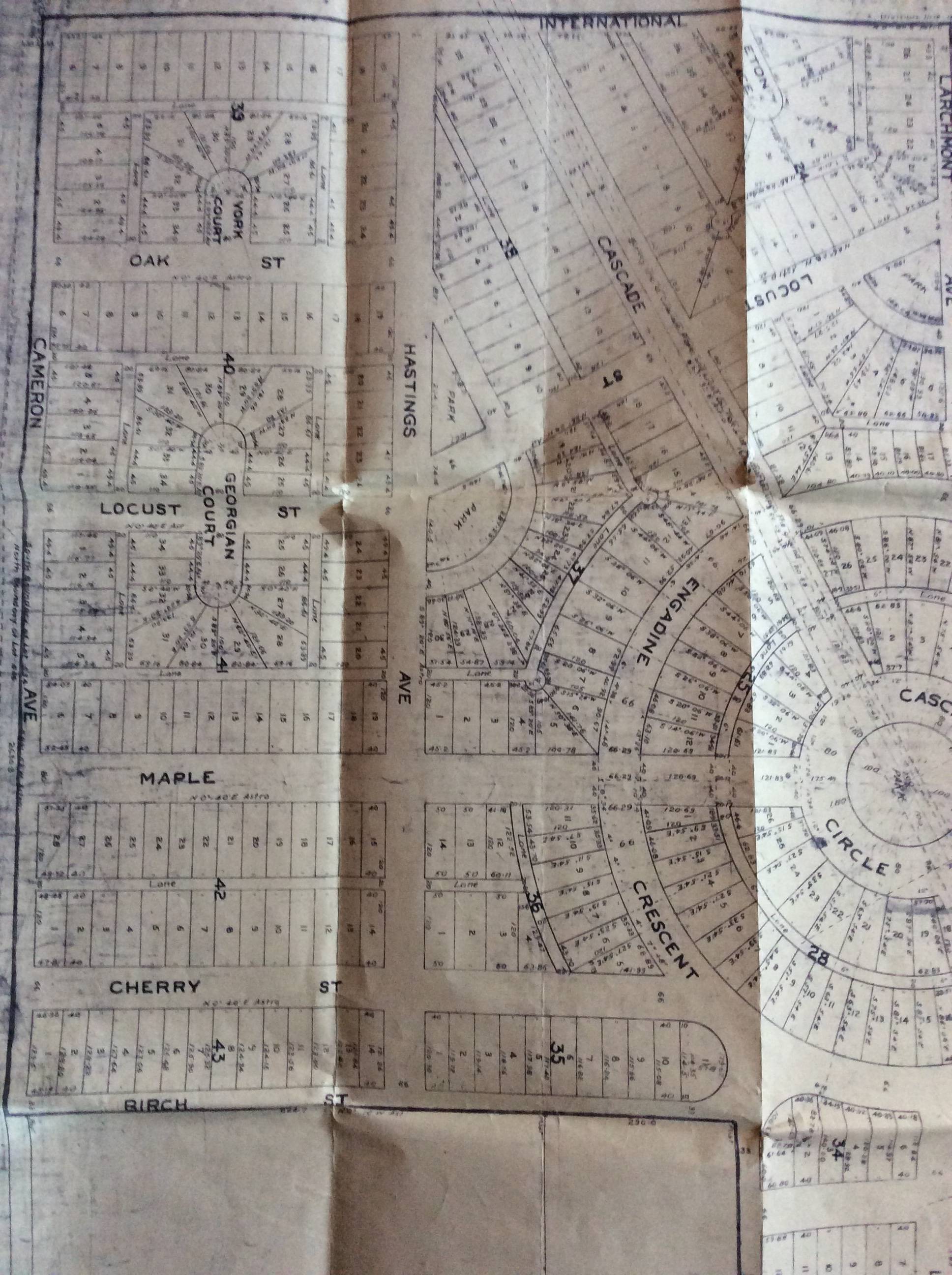
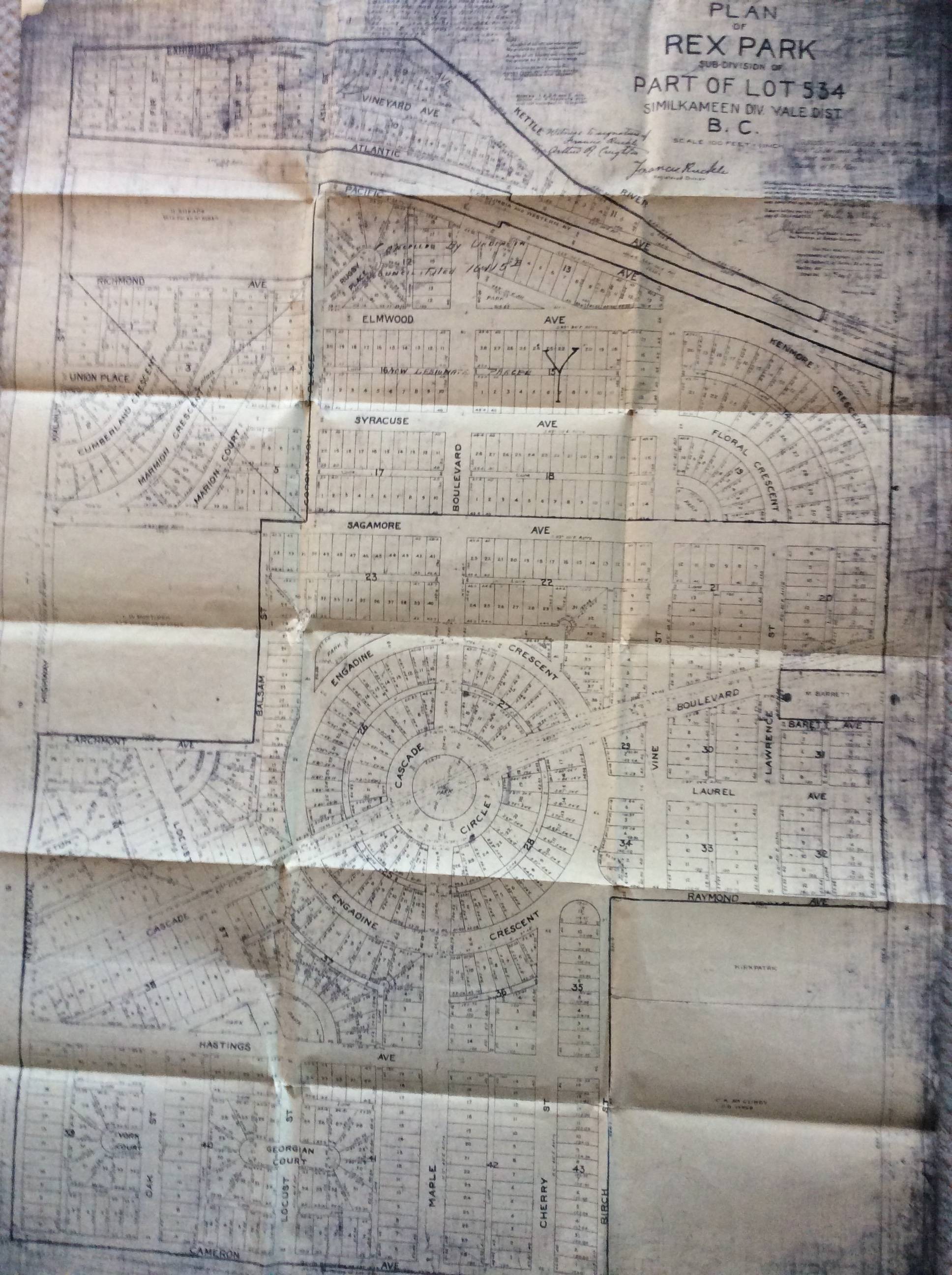
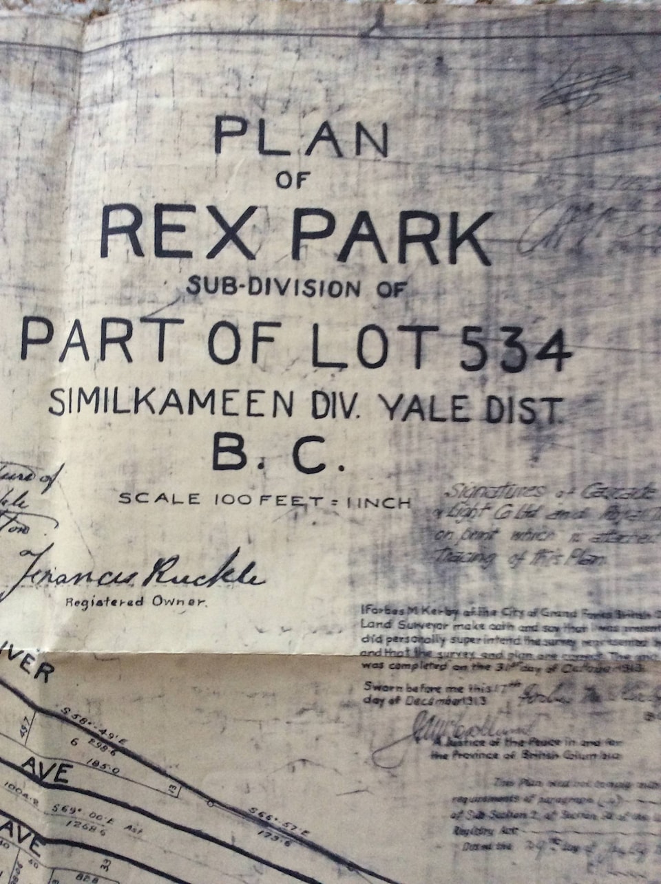
Paul Voykin recently posted a fascinating map on Facebook showing a Grand Forks townsite addition called Rex Park, in the Vienna Woods/airport area between the Kettle River and Cameron Avenue.
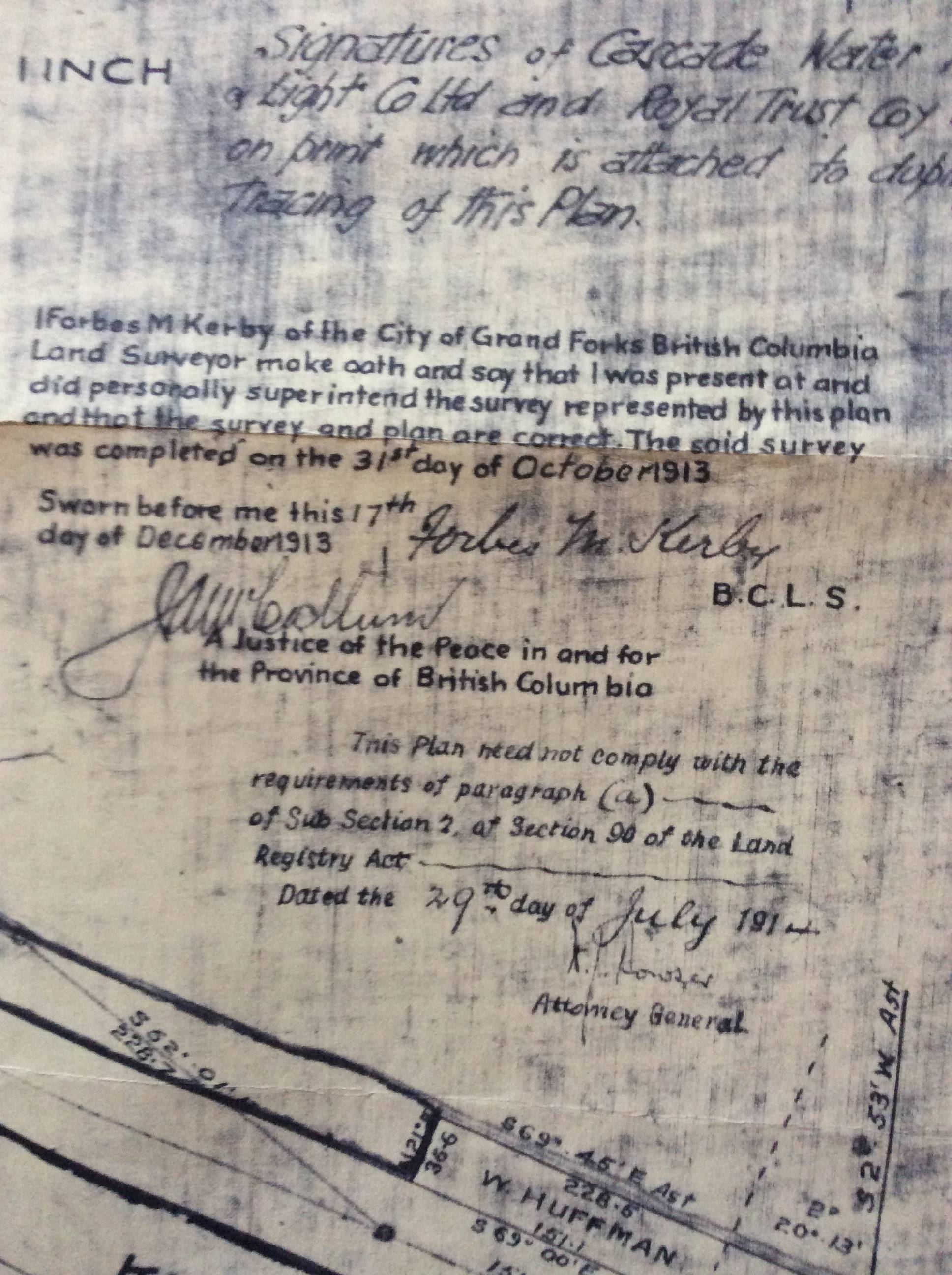
The survey was completed by Forbes M. Kerby on Oct. 31, 1913 for owner Francis Ruckle (one of the brothers for whom the Ruckle neighbourhood was named).
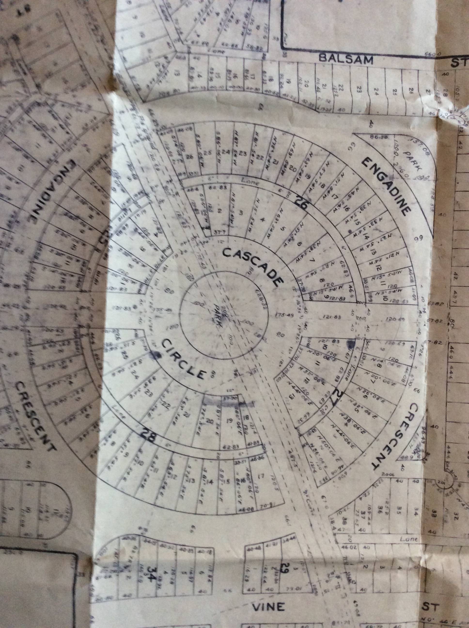
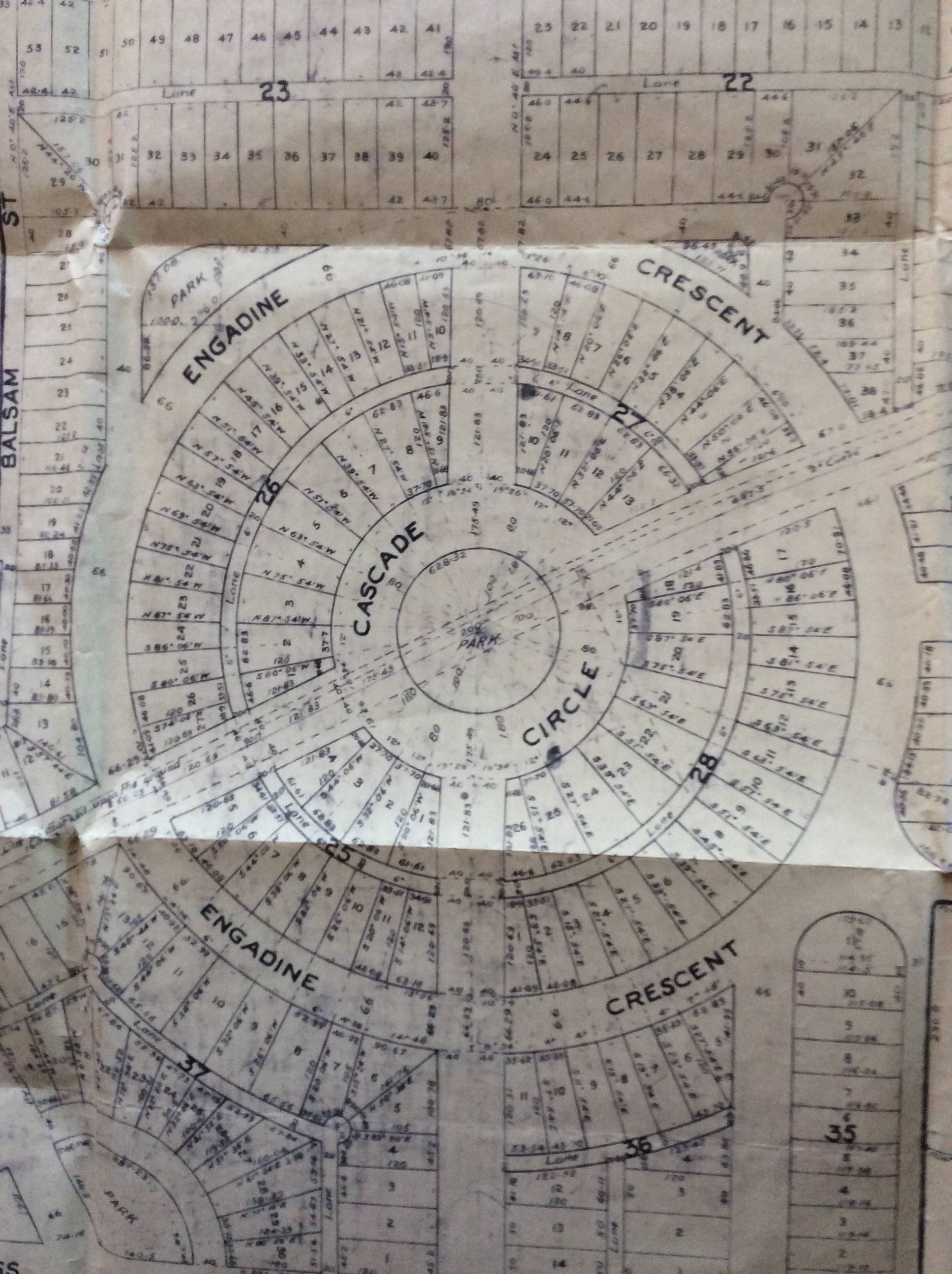
The subdivision radiated out from a hub known as Cascade Circle, which was surrounded by Engadine Crescent and traversed by Maple and Cascade boulevards — a piece of Cascade Boulevard survives today.
Other remaining vestiges of the plan are Cameron, Laurel, and Barrett avenues, Kenmore Boulevard (now Kenmore Road), Sagamore Avenue (now Sagamore Road), Vine Street, Lawrence Street (now Lawrence Road), and Cumberland Crescent. But they are so disconnected you’d never guess they were part of the same plan.
Roads that were never built included Vineyard, Atlantic, Larchmont, Richmond, Elmwood, Syracuse, Hastings, and Raymond avenues; Floral, and Marmion crescents; Marion Court, and Oak, Balsam, Locust, and Cherry streets. There were also a couple of smaller hubs named Georgian and York courts.
Who was Rex? It’s not clear, but rex is Latin for king, so possibly it honoured King George V.
Rex Park was last mentioned in 1922 when a few lots were up for grabs in a tax sale.
Voykin got the map from his father, who probably obtained it in the late 1950s or early ’60s when he built a home on Kenmore Road.
Meanwhile the name Vienna Woods has been used in Grand Forks since at least 1967, although it’s not known how it came to be applied.
A 1973 issue of Mir magazine commented that “The woods should better have been named ‘Venice Woods’ in view of the countless dirt track roads which criss-crossed the area, not unlike the canals of Venice.”
KANGAROO TRAIL, REVISITED
A recent installment in this series on Nakusp neighbourhoods briefly puzzled over the origin of Kangaroo Trail, a road between Brouse and Crescent Bay. Resident Ien van Houten provides some insight.
“In the spring of 1971, when we first came to camp on the land we had bought the previous fall, Scott Comyns, age 12, gave us a guided tour of the neighbourhood,” she recalls.
“At the time what is now Beech Road was known as Huckleberry Lane. Bartley Road was not even a road yet. The government had not yet expropriated a strip of land for the road allowance. Past us in an easterly direction there was just a trail. We walked it till it made a sharp turn to the left, then cut through the swamp till we came to a corner with a larger trail that went uphill to Box Mountain.
“At the corner with the larger trail stood the remains of a log cabin. It had once belonged to an Australian trapper. And that is why that road is called Kangaroo Trail.”
Van Houten doesn’t know the trapper’s name and isn’t sure who told them about it or when the cabin was torn down. But it was known as Kangaroo Trail even then.
SOURDOUGH ALLEY REVISITED
Jackie Drysdale, late of the Rossland Heritage Commission, comments on our installment about Sourdough Alley, the early business district that grew up on in 1895 on land granted to the Nelson and Fort Sheppard Railway.
“One of my surmises is that it not only was one of the foot traffic path up to the mines but it also must have been the route taken by the wagons taking ore to Trail Creek Landing,” she says.
“1893 saw the creation of the wagon road and we know it went south from the corner of Columbia and St. Paul and then travelled down and through Trail Creek valley — so, from the mines to the east end of Columbia Avenue, perhaps the wagon road skirted the township?”
Drysdale notes that in 1894-95, more permanent buildings began to appear at the corner of Columbia and Spokane Street. Spokane was the entrance to (or exit from) Sourdough Alley.
“Location is everything, so why not have the first shacks, tents, and hastily erected buildings offering services to the miners located here?”
She adds that while eastern development of the townsite was initially hindered by streams flowing across Columbia Avenue, Sourdough Alley was north of those impediments.