Two hundred forty-sixth in a series on West Kootenay/Boundary place names
RIVERDALE, ROCK ISLAND
Rivervale is a neighborhood just north of Trail but there was also Riverdale, which according to Port of Nakusp was one mile south of East Arrow Park on Upper Arrow Lake.
A telegraph office was established there in 1912, but otherwise it remained obscure and never showed up in the civic directory. A telegraph office was also established at Rock Island, 12 miles south of Nakusp, which was first listed in the 1918 civic directory. The one resident was farmer R.L. June. It remained listed through at least 1948. The name survives in Rock Island Road and Rock Island Resort (both on the lake’s south shore).
A different Rock Island near Trail was first mentioned in the Nelson Miner of Feb. 27, 1892: “Men are at work removing obstructions to navigation at Rock island and Tincup rapids.”
However, the name was not formally adopted until 1990.
SHOLTZ
This obscure spot appears on the CPR’s 1897 map of the Kootenay district on Lower Arrow Lake. It was included in the civic directory that year as Sholto, “A steamboat landing seven miles from Robson.” No residents were listed and was not included the following year.
The name’s origin is unknown, but if the latter spelling was correct, Lord Sholto Douglas (1872-1942) is one possibility. He was a brother to the Marquis of Queensberry, and moved to California in the 1890s, where he married stage actress Margaret Mooney. They later moved to Seattle.
By 1910, he declared he had spent his fortune on his wife and left Spokane to work on a CPR survey crew for three months at $2 per day. But that was 13 years after Sholtz/Sholto appeared on the map and swiftly disappeared.
STANWELL, TROUTDALE, WESTEND
These were all stops on the CPR’s North Fork subdivision (also known as the Hot Air Line).
Stanwell was 24.9 km north of Grand Forks. The earliest reference appears in the Grand Forks Sun of May 1, 1925: “All of the above are situate in the yard at Stanwell Siding, BC, at Cedar Creek, near Grand Forks.”
The namesake is unknown. Among other things, Stanwell is a village in England, a town in Australia, an electoral ward in Wales.
Troutdale was 12.9 km north of Grand Forks. Its origin is also unknown.
Westend was so named because it was at the west end of Grand Forks. It was the point where the line connected with the CPR’s Boundary subdivision. It’s easily confused with Weston, a Great Northern stop one mile west of Grand Forks that we’ve previously covered.
TAMARAC
Tamarac Siding (or Tamarack) was a little north of Ymir on the Great Northern Railway, and named for the Tamarac mine which staked by 1897, and in turn named for a type of larch tree.
The first reference to the siding was in the Ymir Herald of March 18, 1905, which mentioned the body of James Westgate was discovered “lying on the snow near the Tamarac Siding.”
In 1918, Tamarac was listed in the civic directory as “a spur on the GN Ry. 2 miles from Ymir and 25 miles south of Nelson.” Three residents were given: J.B. Brenner, E. Jordan, and A. McDonald.
It was last listed in 1932, without any residents.
TAURUS
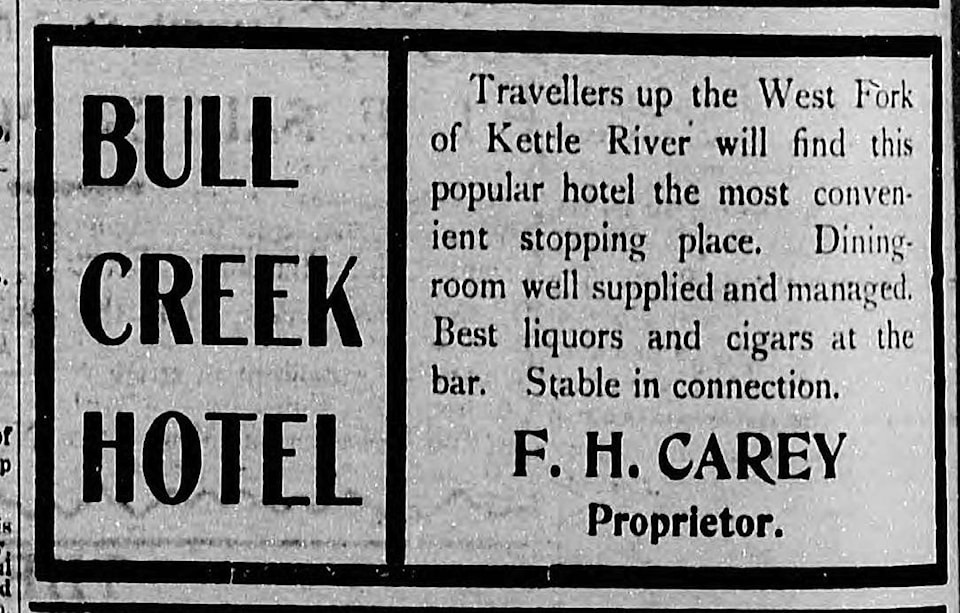
According to Roger Burrows in Railway Mileposts: British Columbia, Vol. II, this CPR flag station, 11 miles south of Beaverdell, was originally named Bull Creek, but was renamed Taurus — Latin for bull — to prevent confusion with Bull River on the CPR’s Lake Windermere subdivision.
Bull Creek was first mentioned in the Boundary Creek Times of July 23, 1898: “D.R. Campbell, J. Cameron and M. McLain have returned from a prospecting trip to Bull Creek.”
A hotel existed there, operated by W. McBoyle in 1901 and F.H. Carey in 1902. Gorman West had it from 1906-12.
The earliest reference to Taurus was in a list of Kettle Valley Railway stations published in the Kelowna Record of June 10, 1915. Taurus was listed in the civic directory through at least 1948, but without any residents.
Bull Creek became Taurus Creek, which flows into the West Kettle River. The name was adopted in the 1930 BC Gazetteer.
WATTS LANDING
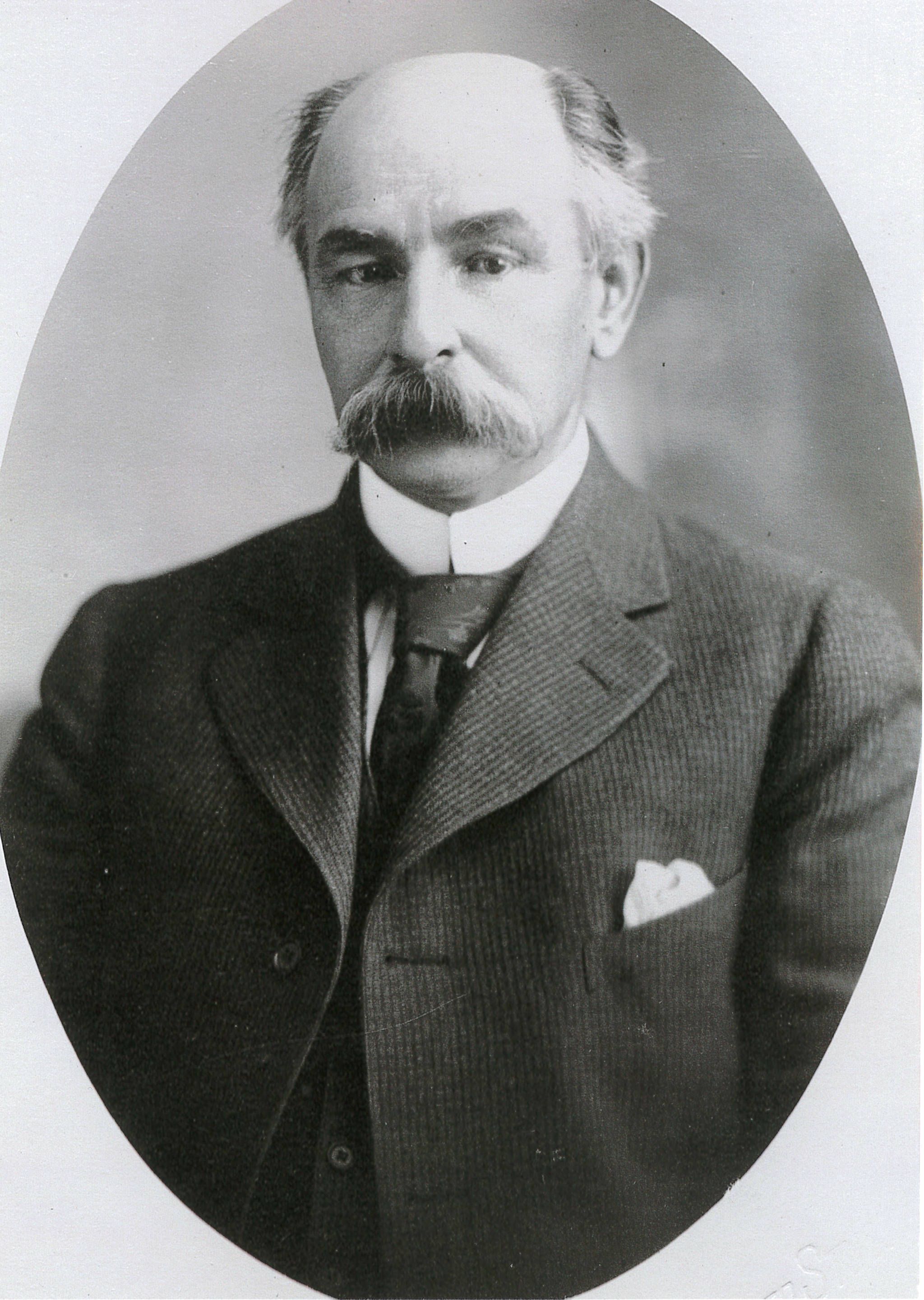
This place slightly west of Procter on Kootenay Lake was named after lumber baron Alfred Edward Watts (1856-1937), who owned a sawmill in the area. He also the namesake of Wattsburg, west of Cranbrook, later known as Lumberton.
The landing was built and named around 1907 and appeared on the CPR timetable. However, according to a typically blistering letter from Watts in the Cranbrook Prospector of Nov. 16, 1912, CPR sternwheelers smashed into floating buildings at the landing, and afterward “a peremptory order was issued that the Landing be cut out as a stopping place without even consulting any person or persons interested.”
He demanded restoration of “the steamer landing known as ‘Watts Landing,’ Kootenay Lake, which they have destroyed.” Watts filed an official grievance on this and other matters, but it doesn’t appear he won any satisfaction.