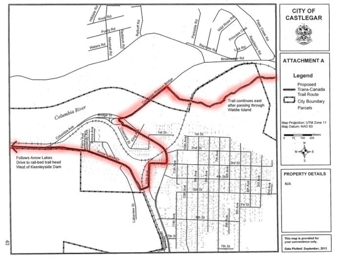
Routing for the Trans Canada Trail through Castlegar was endorsed at the regular City of Castlegar council meeting on Monday, Sept. 23.
The trail will link the rail-bed trail head west of Keenleyside Dam to the east side of Waldie Island, in a short pass through the downtown core. Approximately 30 small signs, about 4" x 4" or 6" x 6," will be placed directing hikers, bikers and other travellers along the route.
From the Trans Canada Trail website:
"The Trans Canada Trail is one of the world’s longest networks of trails, developed and promoted by a non-profit registered charity.
When completed, the Trail will stretch nearly 24,000 kilometres from the Atlantic to the Pacific to the Arctic oceans, linking 1,000 communities and all Canadians.
Today, nearly 17,000 kilometres of Trail have been developed. Millions of Canadians and international visitors are using the Trail to hike, cycle, ski, horseback ride, canoe and snowmobile.
The Trans Canada Trail offers countless opportunities to explore Canada’s diverse landscapes and rich history."
Learn more at tctrail.ca.