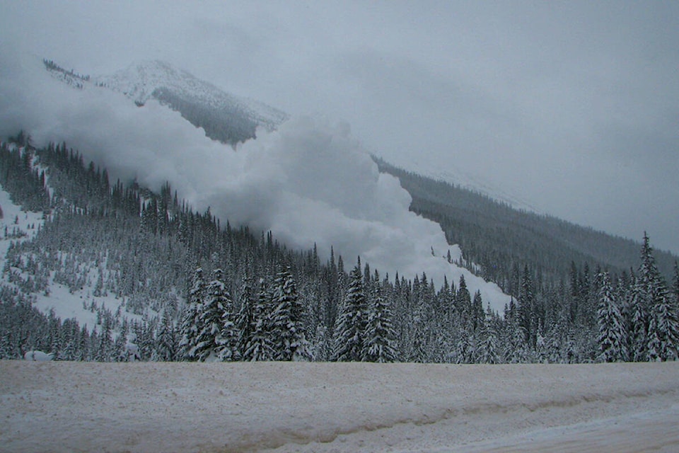
It has been a week of significant change for the snowpack throughout the Interior of B.C., as a big warm and wet storm passed through, interrupting weeks of very cold temperatures.
That recent storm, which passed through on Wednesday, Jan. 12, caused the avalanche danger to increase significantly, however now that the storm has passed, Avalanche Canada is anticipating an improving trend, with most mountain ranges trending from considerable risk to moderate — it’s just a matter of how quickly things will improve and how that will vary between regions.
READ MORE: Sea-to-Sky at highest risk of avalanches as storms hit southern B.C.
“With these kind of intermediate-level conditions, like moderate and considerable, the idea is that avalanches are likely in specific types of terrain,” said Avalanche Canada forecaster Simon Horton.
“Whereas in high danger you might expect avalanches everywhere, or low danger very few avalanches, right now it’s that tricky period where some slopes are dangerous and other ones aren’t and that’s where that training is the first step to being able to identify different types of avalanche terrain, and then experience to know how to move through it and avoid those slopes which are dangerous.”
As of Thursday, Jan. 13 that warming trend has conditions in most regions sitting at considerable. In the Lizard Flathead and South Rockies regions, particularly in the high alpine and treeline altitude, the risk level is high, and below treeline is considerable.
Forecasts indicate that stabilizing through the weekend, moving from high to considerable in the higher altitudes by Friday and into Saturday, with the below treeline level looking to settle to moderate.
Whereas these areas are looking to stay warmer, longer, up around Revelstoke it should start cooling back off by Friday, and as temperatures go down, the risk of avalanches decrease as well.
“Conditions have been changing quite rapidly the last couple of days and with every new weather forecast that comes out we’re kind of re-evaluating what that means for avalanche conditions, so I kind of anticipate that rapid change will continue at least into tomorrow and Saturday as well,” Horton said.
Horton said that one important thing to note is that, for these regions specifically, over the Christmas holiday period there were quite a few large avalanches, which occurred on an older, weak layer that was formed back during the last atmospheric river during late November and early December.
There were a lot of human-triggered avalanches, particularly in the West Kootenays around Nelson, but also up towards Invermere and in the Fernie area.
“We’ve seen a bit of a decline in these avalanches in this last week, but with this warm weather we’re a little suspicious that it still might be possible for people to trigger these large avalanches,” Horton said. “And that makes conditions a little tricky as well because, when these layers are so deep it might not be obvious as you’re travelling through the mountains that slopes are dangerous with these types of avalanche problems.”
With snowpacks sitting at an average depth of one to two metres, the potential for a large avalanche, while not necessarily likely, creates a high level of consequence should one occur. That combined with a level of uncertainty regarding how this current weather is impacting the snow, Avalanche Canada can only recommend being more conservative with where you travel.
“The usual message we have is to get the training, get the gear and get the forecast and I think that last little bit of getting the forecast is really pertinent now because everything’s changing,” Horton said. “I think we’re going to be updating these every day and you can probably get the best information for your local area that way by checking the current forecast.”
Additionally, with current conditions, Horton expects things to look very different as you move up into higher terrain, away from where the rain and warming has affected the snow down low.
“I’d advise people to be really alert to what’s changing as they move higher up in elevation and into areas where there’s been wind or more dry snow because conditions could change quite a bit as you move through the mountains right now,” he said.
With the newer snow that fell yesterday, there are fairly obvious signs to look out for; cracking, large “woomf” sounds. With the older snow, there are not a lot of visible clues, so it is important to understand what types of terrain that type of problem might exist in, knowing what the forecast is saying, and potentially avoiding those areas.
With this level of uncertainty it is more important than ever to check www.avalanche.ca for up to date conditions if you’re planning a trip into the back country.
paul.rodgers@kimberleybulletin
Like us on Facebook and follow us on Twitter
