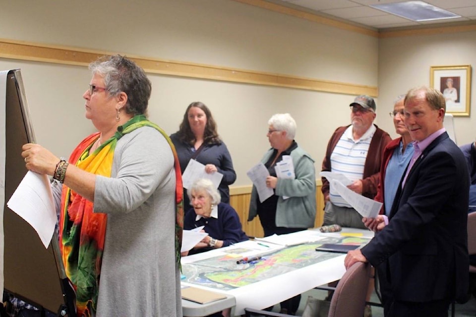
Those who attended a workshop to discuss Castlegar’s waterfront last Thursday night made it clear they’re opposed to any waterfront access that disrupts private property.
The City of Castlegar held a Waterfront Master Plan Visioning Workshop at the Community Forum on June 15, and many who own property along the riverfront were present to voice their objections to the idea of a waterfront trail extending from the Castlegar-Robson Bridge to Blueberry.
But Don Crockett and Kate Evans — principals and landscape architects with Lanarc Consultants in Nanaimo and leaders of the workshop — protested that there wasn’t yet a line on the page regarding a trail and that they wanted to hear the public’s ideas regarding the waterfront.
Representatives from the consulting company and the city appeared to back away from early language first reported in the Castlegar News on May 4 that depicted a proposed full trail system on a 12-km stretch along the river.
A man from the crowd asked, “I guess you’re looking at having a trail from Millennium Park down to Blueberry? I think that’s kind of what you’re saying isn’t it?”
Crockett said, “No, no, not at all.”
However most of those who spoke up following Crockett and Evans’ presentation — but before those who stayed were broken into the workshop groups — seemed to believe that the workshop was to discuss such a trail.
Asked how people had gotten the impression that there was a proposed trail, Coun. Deb McIntosh replied, “Well, I think what happens is [that] when you take a little bit of information and then you expand upon it and then misinformation gets spread. Because if you’re worried about your backyard or your area, you tend to pick up things and go. And unfortunately, there has been a lot of misinformation out there.”
“We don’t have a proposed trail. Absolutely not,” she continued. “If we had a proposed trail, even if we thought, ‘Hey let’s look into the future and this is what we think could be,’ we would show it. We simply don’t have it. We haven’t had meetings on this to discuss the trail. This is the first meeting, the very first step.”
Shannon Marshall, a planning technician for the city, acknowledged that previous plans had shown a trail “roughed in” along the waterfront, but said it had nothing to do with the Columbia River Waterfront Master Plan.
“The Pedestrian and Cycling Master Plan, as well as a Trails Master Plan, completed by a student at Selkirk College, they both showed sort of a roughed-in trail showing that there was possible a trail there,” he said last Thursday. “There’d been no … in-depth study done as to what the community wanted or whether it was even feasible to have the trail there. It was shown on a map a number of years ago, like I said back in 2007, but that’s not what this is about.”
But a request for proposals (RFP) authored by Marshall and included in the council meeting agenda for May 1 included the following statement: “Recognizing the potential to expand on the work done to date, the City’s intent is to develop a recreational and nature trail along approximately 12 kilometers of waterfront, stretching from Castlegar’s north end south to the Blueberry neighbourhood (See Figure 1).”
Figure one then shows a yellow line running along the riverfront between the Castlegar-Robson Bridge and Blueberry, labeled “Potential Trail Route.”
Asked about this on Friday, Marshall said, “It is a potential trail route, but it wasn’t worded… I guess it could have been worded better. It is a potential trail route for sure. There is that possibility, but none of that was decided. You know, it’s ‘Features could include a variety of amenities, rest areas, information signs, shelters, etc.’”
The RFP specifically reads: “Features along the trail may include a variety of amenities, including rest areas, information signs, shelters, etc.”
“So that was just at the RFP stage, before we’d had a chance to have our initial meetings with the consultant. And once we met with the consultant and I had a closer look at this project and figured that the focus should be on the provision of a variety of amenities, we decided to go forward,” he added.
At that point, they also decided to rename the project from “Columbia Riverfront Trails Master Plan” to “Columbia River Waterfront Master Plan.”
And then in an email sent later that day, Marshall wrote, “At the project start-up meeting with Lanarc, we discussed the overall objectives of the plan and felt that its name should reflect the potential for a host of other waterfront amenities, as indicated in the RFP. While we have received feedback regarding the potential of a trail for a number of years when consulting with the public for a variety of planning projects, we wanted to ensure that the name of the plan made it clear that we hoped to hear from the public a range of ideas and opportunities to improve access to the waterfront.”
For the most part, riverfront property owners who attended last Thursday’s workshop made it clear they wouldn’t be amenable to a trail cutting across their properties.
Kat Enns is a riverfront property owner and has already found herself at odds with the City of Castlegar when it comes to her property’s water access and the city’s intentions to build trails.
Last year, Enns applied for accretion rights to her property. Essentially what that means is that land had “slowly and naturally” accumulated and taken on “upland characteristics” where her property is bordered by the Columbia River and, as per B.C.’s Riparian Rights, she was able to claim ownership of that land.
In response to Enns’ application, Phil Markin, director of development services for the City of Castlegar, sent an email to Survey General Services, which opened with the following paragraph: “This letter is to advise that the City of Castlegar has serious concerns with respect to the above-referenced application. The area in question has been identified as a future Columbia River Trail Extension in the Official Community Plan, the Millennium (Twin Rivers) Park Master Plan and the Bicycle and Pedestrian Master Plan.”
In response, Kathryn Hannah, deputy surveyor general, sent a reply saying that despite the City of Castlegar’s concerns, they would be approving Enns’ application. The response explained that the extent of ownership was dependent on the location of the natural boundary, i.e. the Columbia River, and not the lot as drawn on a plan.
“As such, much of the land along right bank of the Columbia River that has been slated for trails in the Official Community Plan is privately owned. Should the City of Castlegar wish to continue to fulfill the goals outlined within their Official Community Plan, they will need to acquire the right to build trail from the waterfront owners,” Hannah added in the letter.
Enns’ neighbour, Don Mair, read from both letters at the workshop last week.
Following breakout sessions, the six groups reported back to each other, and all but one made it clear that respecting private property was a priority.
Other suggestions included developing existing trail networks, building a bridge from Selkirk College to the Castlegar-side bank, developing the Brilliant Flats area and developing public road ends as lookouts.
For those who weren’t able to attend the workshop, you can still contribute by filling out the questionnaire at castlegar.ca/pdfs/Visioning%20Workshop%20Discussion%20Guide.pdf and dropping it off at City Hall or sending it to devserv@castlegar.ca.