by John Boivin
Local Journalism Initiative Reporter, Valley Voice
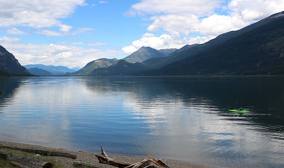
People living along the shore of north Kootenay Lake or Slocan Lake may see a slow-moving boat filled with people passing by their properties at some point later this summer.
The people in the boat won’t be trolling for lake trout, however – they’ll be doing a detailed survey of the condition of the natural shoreline, and the human activity that’s affecting it.
It’s all part of an inventory being done by Living Lakes Canada to update the characteristics of shoreline habitats and human development on lakes in the region.
“The survey identifies land use, such as industrial vs residential vs commercial,” says Georgia Peck, the acting program manager for the Foreshore Integrated Management Planning (FIMP) project. “You’ll have someone identifying shore type, you have one person counting the number of docks, weirs, or other man-made developments, one person making note of any wildlife, emergent vs underwater vegetation, etc.
“There’s a lot of criterion that are looked at when we are doing the actual boat work. So it’s a pretty comprehensive process.”
Living Lakes Canada is halfway through a four-year agreement with the federal department of Fisheries and Oceans to review and revise the FIMP methodology, and map (or re-map) six-to-eight lakes in the Columbia Basin. The goal is to assess the rate of change in ecological and urban development along the land-water interface.
Using the information gathered in the survey, Living Lakes will re-map shoreline habitat, assesses habitat value and establish shoreline development guidelines. Those guidelines are used to help conserve ecosystems, support climate resiliency, and protect species of concern. Having that information will allow decision makers to choose the best management practices to protect the delicate ecosystems.
Foreshore surveys have been done before on the lakes, but it’s been at least a decade since the last one. This latest survey will update, expand and improve on the quality and quantity of the research, to make it more useful for groups, individuals and government planners, says Peck. She says an initial project last year on the East Kootenay’s Lake Windemere did just that.
“It allows us to re-assess the landscape-level changes over a 10-year time frame,” she says. “Ideally the results we get from that will allow for updates for water-surface zoning, and help protect sensitive parts of the shoreline, and assist with property owner outreach and education.”
The new survey process, however, is very complex, and part of the project is also to train up FIMP surveyors to be able to do surveys on their own.
“The updated methodology was designed to train more people,” Peck told the Valley Voice. “More people need to be able to do this work. We need more proposals to allow this work to take place on as many lakes as possible. That was really the objective to updating the methodology.”
The contract for the surveys of Slocan and North Kootenay Lakes should be let by the end of June, with work on the water taking place later this summer.
One important new aspect to the data collection and reporting is that the project will incorporate archaeological and Ktunaxa Nation cultural values. Living Lakes says this will set a precedent to meaningfully recognize and protect Indigenous values in the area.
“That is something that has been newly added to the methodology,” says Peck. “Archaeological and cultural values, including knowledge related to historical species at risk, as selected by the First Nation, is held confidentially by the First Nation and then applied for decision making.
“It really supplements the present data we’re collecting.”
While the public will have access to the data, Peck says it will be a very technical document, and not easily accessible to the lay person who may live along the lakeshore.
“It’s very complicated, and it has to be, there are so many moving parts of the foreshore, to get a snapshot of the foreshore health that much work has to go into it.”
“The guidance documents for development would be used by local and provincial governments when applications for development come in,” she adds, though property owners can also gain insight from it.
“It gives property owners a good idea of how, say, they should build a retaining wall. ‘Should I leave vegetation as a buffer? Can the species that depends on my property, would they be impacted if I built a dock or what have you?”
As the project develops, Living Lakes plans to expand its studies. It’s already begun FIMP work in Lac La Biche in Alberta and southern Lake Winnipeg in Manitoba.