On July 24, the Regional District of Central Kootenay reduced a portion of the area currently under evacuation order to an evacuation alert for the Michaud Creek wildfire burning on the west shore of Lower Arrow Lake,.
In the Edgewood area south of Robinson Rd and the Lower Inonoaklin-North Branch, 184 properties will remain on evacuation order, while 172 properties in the Edgewood area, primarily north of Hwy 6 and Whatshan areas, have been reduced to an evacuation alert.
This reduction to an alert means residents can return to their properties, but must be prepared to leave on short notice should conditions change. See a map and a list of properties here.
The Michaud Creek fire is estimated at 4,600 hectares in size as of the morning of July 25, at which time the BC Wildfire Services (BCWS) stated in a bulletin that the fire “continues to hold at established control lines south of Johnson Creek. Fire behaviour has continued to be less active due to lighter winds and heavy smoke in the area reducing temperatures slightly. That smoke, however, is impeding air support operations.”
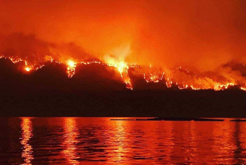
Meanwhile, on the east side of Lower Arrow Lake, the Octopus Creek fire, which has forced the evacuation of the communities of Applegrove and Fauqier, has grown to 11,444 hectares, up from 2,940 on July 20.
A BCWS bulletin states that “aggressive fire behaviour continues to be observed, though has reduced compared to previous days due to lighter winds and slightly cooler temperatures. The fire has backed down to the shores on Lower Arrow Lake and is very visible from Edgewood, Fauquier, Needles and surrounding areas.”