After over a year of research, consultations and development, the Regional District of Central Kootenay has adopted a ten year park management plan for Pass Creek Park. The 35.2 hectare park in Robson is a well used facility, especially during the summer months when swimming and camping are at their peak. The park also has sports fields and is the home of the fall fair, Bluegrass Jamboree and equestrian events.
Pass Creek Road and Norns Creek (aka Pass Creek) physically divide the park into three distinct sections. The east side of the park has historically been managed by the RDCK, while the west side has been leased to the Pass Creek Regional Exhibition Society. The northeast section of the park, east of Pass Creek Road remains in a natural state.
The new management plan is designed to guide future development, operations, investments and decisions regarding the park. "There are a number of suggestions of things we could do," said Jim Crockett, manager of recreation for the Castlegar and District Recreation Commission (CDRC). "Really what it is, is a summary of a variety of different options that resulted from all of the community consultation pieces, all of the pieces with staff, and any other stakeholders in the park. We will progress as budget and other factors permit."
Crockett explained that items that fall under public safety and risk management will be prioritized to be done as soon as possible.
The plan sets forward 17 goals. Several of those goals revolve around protecting Norns Creek and the wildlife that are dependant on it. Protecting and enhancing the riparian areas (the interface area between land and a river or stream) will mean establishing a 30-metre setback and working on restoration of vegetation within the zone. Given the existing level of recreational use and disturbance within the park, the objective will be to limit and/or prevent further modification of natural areas. Maintaining critically important fish habitat within Norns Creek is also a priority.
A series of park enhancement goals are also in the plan including: undertaking parking and signage improvements to create an inviting interface with public streets at the main entrances to the park, creating an inviting on-site parking and staging area including park informational signage on the west side of the park from the Relkoff Road access and defining a parking and staging area on the east side of the park. The existing parking areas will remain, but expansion into the riparian zone will not be allowed.
In order to enhance connectivity between the east and west sides of the park several options are listed including providing a safe pedestrian route along Broadwater Road and investigating the possibility of installing a footbridge across Norns Creek. A bridge across the creek could double as an observation platform to view spawning fish and may enhance the park as an environmental education destination.
Improvements to the swimming pond will also be investigated to reduce water loss and the need for greater water extraction from the creek.
According to the plan, due to the inherent liability of the campground due to the potential for tree fall hazards, the campground operations should be assessed and audited to determine its community value. The area could potentially be repurposed for other daytime, lower risk community activities (e.g. Environmental Education Centre). Other options include the periodic closure or repurposing of the highest risk campsites.
The camping and parking of trailers that was taking place on the west side of the park in the treed area behind the equestrian barn will no longer be allowed, as the area was never intended for that use and is part of the area set aside for wildlife and habitat preservation.
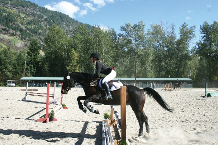
The plan gives guidance to continue to support and enhance community events and equestrian uses and to explore ways to further develop the relationship with the Pass Creek Regional Exhibition Society.
It is a good thing with so many things to do that the plan has been set forth as a ten year plan. The CDRC will be working on these plans for years to come. "There are some fairly big decisions that are yet to be made that are framed in the plan," said Crockett. "A guiding document is the best way to describe it [the plan]; so the commission can work our way through it and address the pieces that make sense to help make the park a better park."
"The whole plan was a balancing of use and conservation," explained Crockett. He acknowledged that there may be some pieces people are upset about but stated, "It is for a good reason. We are recommending we protect the riparian zone and the creek."