More than 20 fires continue to burn in the West Kootenay with several of them prompting evacuation alerts and orders.
The Regional District of Central Kootenay issued an evacuation alert Tuesday for the area south of Renata. Three fires are burning in that area: east of Dog Creek (11 hectares), south of Renata Creek (two hectares) and a second one south of Renata Creek (300 hectares).
The Renata Creek fires are located in the Bulldog Mountain area, about five kilometres south of the community. It was zero percent contained as of Wednesday morning and is considered an interface fire.
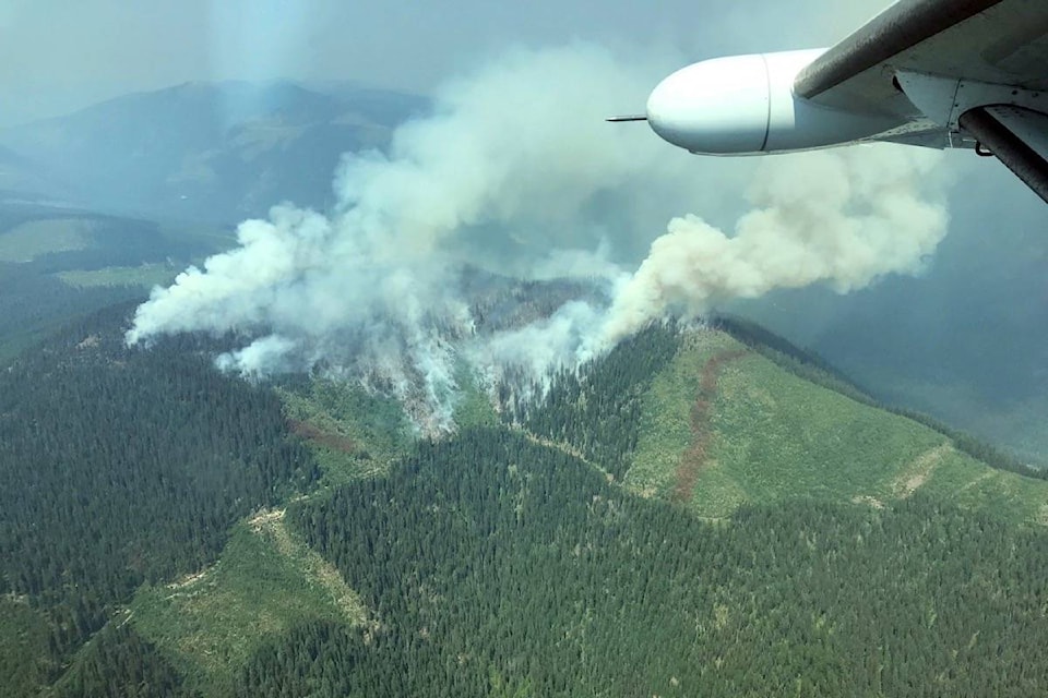
Syringa
A fire burning north of Syringa Creek Provincial Park has grown to 39 hectares. It has been moving northerly since lightning sparked it on Aug. 11. Originally, there were two fires, but they have now combined into one.
Air assessment took place on Wednesday. The fire is burning at the top of a hill, at an elevation of more than 1,600 metres, according to the Southeast Fire Centre.
Another fire is burning north of Deer Park and is about 29 hectares.
Salmo
The MacArthur Creek fire is in the Mount Waldie area, 13 km southeast of Salmo. An evacuation order was issued Friday for a handful of properties. The fire has grown to over 200 hectares.
HWY 3
The Blazed Creek fire, located two km north of Highway 3, approximately 26 km northwest of Creston, has grown to over 5,000 hectares. At times it has caused the closure of Highway 3. A travel advisory remains in effect for possible sudden closures due to wildfire activity but the fire is not a threat to any communities.
Silverton
The Blacktail Mountain fire burning 8 km southeast of Silverton has grown to about 1,900 hectares. It is not an interface fire, but an area restriction is in effect for the entire Silverton Creek drainage, including Idaho Peak, a popular hiking trail accessed from Sandon.
Rossland
Six fires are burning west and southwest of Rossland.
The Swehaw Creek fire is five hectares, Big Sheep Creek is 10 hectares, Hunter Creek No. 2 is 2 hectares, Hunter Creek No. 3 is less than one hectare as is the Hunters fire.
A fire burning about 800 metres from the international border on the American side is about 240 hectares in size and is only five per cent contained. The Horns Mountain fre in Washington state is noted as the Santa Rosa Fire on the BC. Wildfire Service map.
An evacuation alert is in place for all properties within the Big Sheep Creek drainage southwest of Rossland including Hadley Road, Thompson Road, Big Sheep Creek Road, and the portion of the Old Rossland Cascade Highway in the Sheep Creek area. It also includes all properties east of the two kilometer mark on the Santa Rosa Road east of Christina Lake.