One-hundred seventy-sixth in an alphabetical series on West Kootenay/Boundary place names
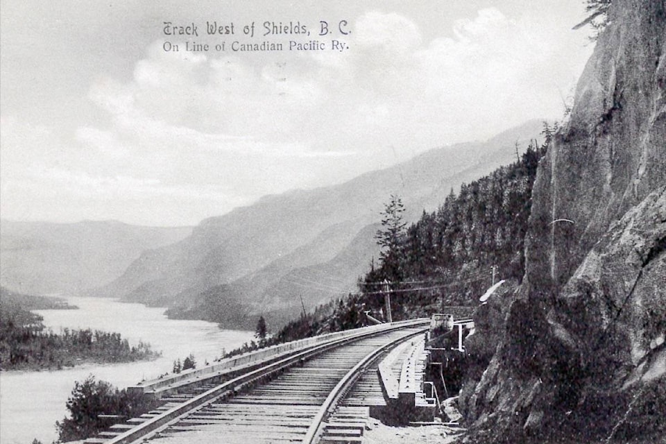
This spot along the former Columbia and Western Railway, 21.5 km west of Castlegar, was formerly known as Shield’s Landing and Shields Station. It was first mentioned in the Midway Advance of Nov. 29, 1897: “With the exception of ten miles, the distance between Robson and Shield’s landing, the survey [of the railway] is completed from the Columbia river to Penticton.” Shields was an important camp during the railway’s construction.
Later it was a flag and water stop.
It has a few potential namesakes. According to Frederick W. Laing’s place names file at the BC Archives, “Robert, Jim, and George Shiell were generally spoken of as ‘Shields.’ They were prospectors and frontier men who ultimately settled at Needles.”
Robert Shiell was among the directors of the Hansard Gold & Copper Mining Co. The Nelson Miner of June 13, 1896 noted the company “will commence on two or three claims lying to the north of the headwaters of Sheep Creek in the Trail district and close to the sources of an unnamed creek which empties into the Columbia River near Shiell’s Landing.”
The only other known mention of Shiell’s Landing by that spelling is in the 1900-01 Henderson’s directory of BC mining companies, which noted the Hansard and Carberry mines were “reached by trail seven miles from Shiell’s Landing, on Lower Arrow Lake.”
Robert Shiell was postmaster at Needles from 1902-08. His great grandson, Jim Shiell, still lives in Fauquier. Alternatively, in Railway Mileposts, Vol. II, Roger Burrows said Shields was “Named for a railway contractor. Sim [sic] & Shields constructed several lines in the US and Canada including the Great Northern between Marcus and Grand Forks.”
That should read Seims and Shields. The company was headquartered in St. Paul, Minn., but partner Litton Edward Shields (1852-1933) was from Spokane. A post office opened on March 1, 1909 as Shields Station, but it’s unclear what necessitated this. It closed a little more than two years later. Very little is left at Shields, but there’s still a Shields Creek and Shields Point west of Castlegar, plus a Shiell Lake, which is an expansion of Inonoaklin Creek, near Edgewood.
SHIRLEY
This area is on Granite Road west of Nelson but the name has faded from use.
The earliest known mention is in the Nelson Daily News of Feb. 10, 1913, although the Shirley Farmers’ Institute was apparently formed in 1908 or 1909.
According to Granite Road Memories, “Shirley was a local name. The district had no legal status and no defined boundaries … It is said that the name Shirley was chosen as it was the name of Mr. [Nelson] Menzies‘ home town in England.”
England has four places named Shirley. (The one near Southampton was the namesake of another Shirley in BC, west of Sooke, which had a post office from 1894 to 1919.) The Farenholtz family ran a dairy at Shirley until 1922. In later years, the name seemed attached only to the community hall, built prior to 1911. The Granite Road Women’s Institute donated it to the Nemrava family in 1984.
Shirley was still a polling station as of the 1979 provincial election, but it’s not recognized today by the BC Geographical Names office.
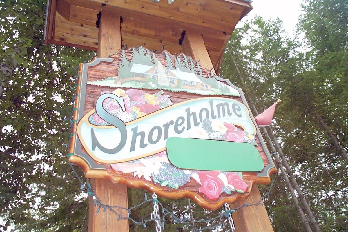
SHOREHOLME
Longtime Kootenay West MP Bert Herridge and his wife Ella gave this name to their home on the east shore of Upper Arrow Lake, about six kilometers north of Nakusp. According to Bugles on Broadway, the property was first staked in 1898 by John Cole — noteworthy as the victim of Henry Rose, the last man hanged for murder in Nelson. Cole’s cabin is still standing. The Herridges bought the property in 1928 from Lyle McDougald, who owned it since 1907.
Jack Harris, Joseph Parent, and Harvard Hiltz cut logs that Gordon Mann assembled into a two-storey home with a large living room and view of the lake.
Shoreholme was a steamer landing and appeared on some maps as Shoreholm or Shorehome, much to the Herridges’ consternation. A letter on the subject survives in the Bert Herridge fonds at the National Archives of Canada, dated Nov. 3, 1954 from W.H. Hutchison, geography division chief of the BC survey and mapping branch.
He wrote: “This will acknowledge your letter … relating to the spelling of ‘Shoreholme.’ As you surmised, in compiling Map 1E — southeastern BC, we were guided by the CPR timetable, but for any future editions of maps of this area we will be glad to show the correct spelling …”
Shoreholme is listed by the BC Geographical Names office as a “locality.” It’s still in the Herridge family, and operated as a bed and breakfast until recently.